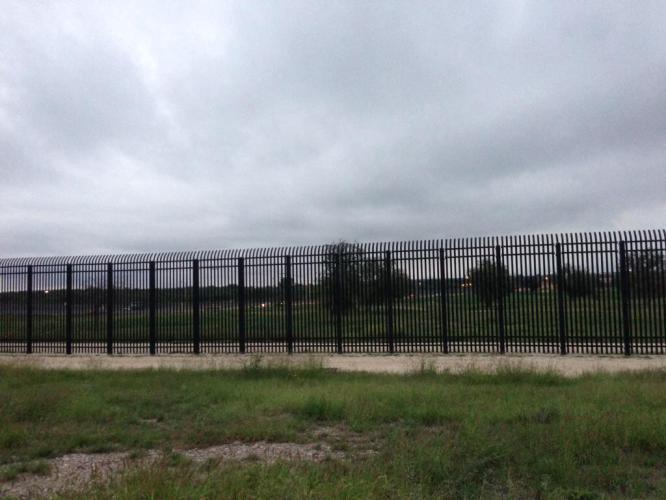
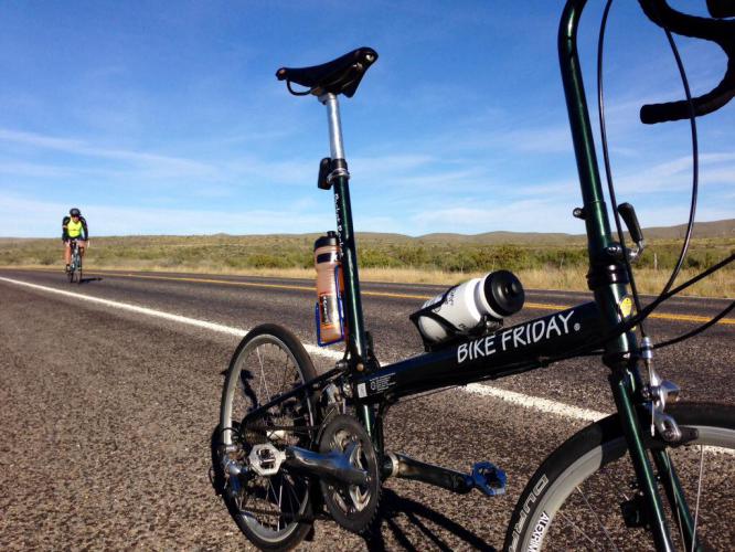
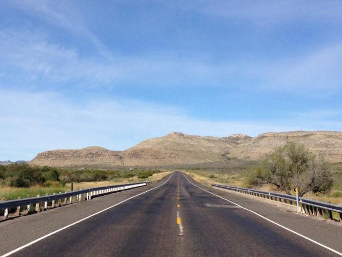
Tim re-joined us on Friday October 11, our final day of riding on L3.  After Beth arranged for us to have a noon check-out time, we left the hotel with our bikes in Silver’s bay and drove to Bracketville, TX so that by biking west to Del Rio, we’d have the winds at our backs again.  We left the hotel around 7:15am when it was still dark, and somehow missed the turn that would have kept us on US 90 and on the right path towards Bracketville.  But we were glad we did get lost for a few minutes, because we came within about 20 feet of the International Fence, the closest we had ever been to the border and the fence.  Beth and Mark took pictures of it, so you can see it on their blogs.

Shortly after 8:00am, Beth dropped us off and we started our way on US 90 West towards Del Rio.  The ride was, fortunately, once again uneventful.  We again passed several ranches bordering the highway and I managed to take a picture of one of the more elaborate ranch signs, this one of the Clearwater Creek Ranch.
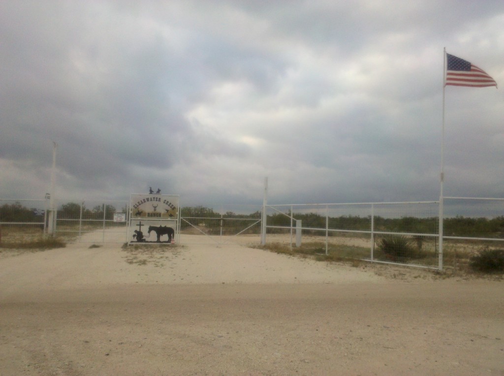
Clearwater Creek Ranch sign, Bracketville, TX.  We passed dozens and dozens of ranches along US 90 between Van Horn and Del Rio, all of which had signs identifying them.  This was one of the more elaborate ones.  By the way, this ranch and its 2,000 acres are for sale, in case you're interested.

Clearwater Creek Ranch sign, Bracketville, TX. We passed dozens and dozens of ranches along US 90 between Van Horn and Del Rio, all of which had signs identifying them. This was one of the more elaborate ones. By the way, this ranch and its 2,000 + acres are for sale, in case you’re interested.

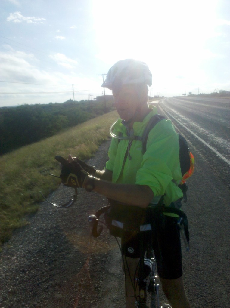
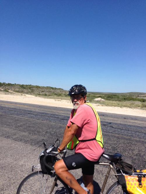
And here’s a picture of Mark and Tim on our very last rest stop of Leg 3.
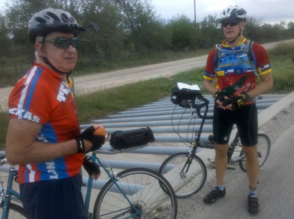
Tim and Mark on final rest stop of Leg 3.  We stopped at a rain drainage culvert along US 90.  The steel bars are there to keep any large solid objects from entering the culvert with the water and clogging it up.

Tim and Mark on final rest stop of Leg 3. We stopped at a rain drainage culvert along US 90. The multiple parallel steel bars act as a grate to keep any large solid objects from entering the culvert with the water and clogging it up.

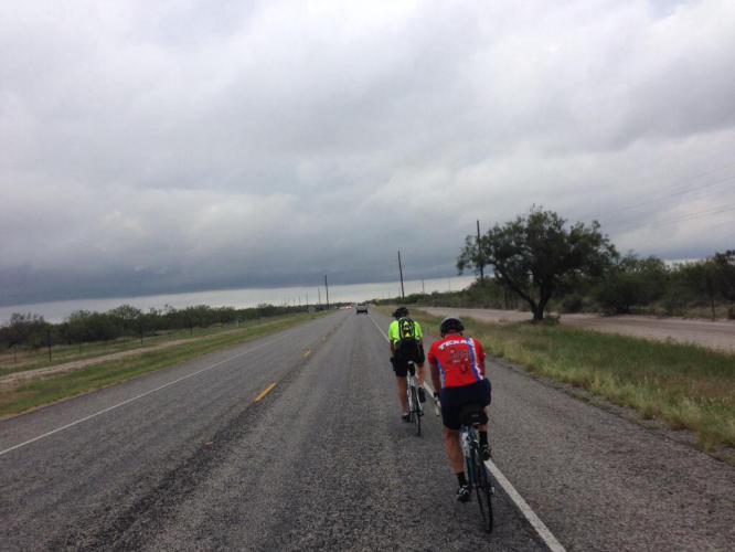
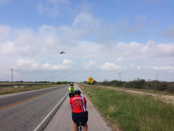
I also took a few final videos of Leg 3 while riding along US 90.  As you can see in the first one, the weather this day was overcast and the dark clouds actually did drop a few raindrops, but we were not caught in a downpour.  We were moving at a pretty fast pace at this point, a train passed by going in the other direction, and you get to see Tim passing me while I was taking the video.   I took the second video as we were passing by Laughlin Air Force Base.  Pilots were practicing take-offs and landings, passing over US 90 at a fairly low elevation, which was a different experience for us.  Hope you enjoy them.

We completed the 31 mile ride in a little more than two hours, arriving back at our hotel by 10:20am, gave each other congratulatory man-hugs, and then went to our rooms to disassemble, pack up our bikes, shower, dress, and check-out by noon, all of which we were able to do.

After that, we decided to drive a good part of the route in Map 4 of the Southern Tier.  We continued on US 90 east past Bracketville and drove into Uvalde, TX, where our Dad was stationed for several months during WWII.  We had planned to pay a quick visit to the John Nance Garner Museum in Uvalde (Garner was the Vice President to FDR during his first two terms and was a native of Uvalde), but as you can see from the photos I took there, the museum is closed for renovations.  Neither Beth nor Mark were too disappointed about that.
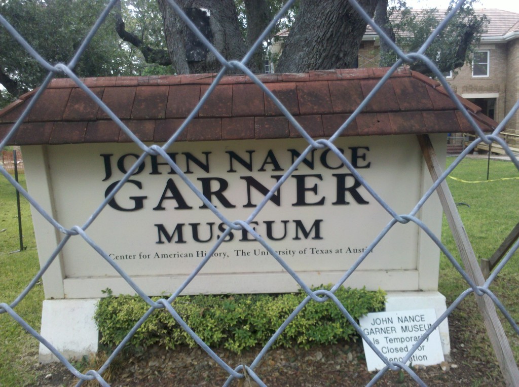
John Nance Garner Museum sign in Uvalde, TX.  The fence and the small sign at the bottom right let us know it was closed.  Beth and Mark were not overly disappointed.

John Nance Garner Museum sign in Uvalde, TX. The fence and the small sign at the bottom right let us know it was closed. Beth and Mark were not overly disappointed.
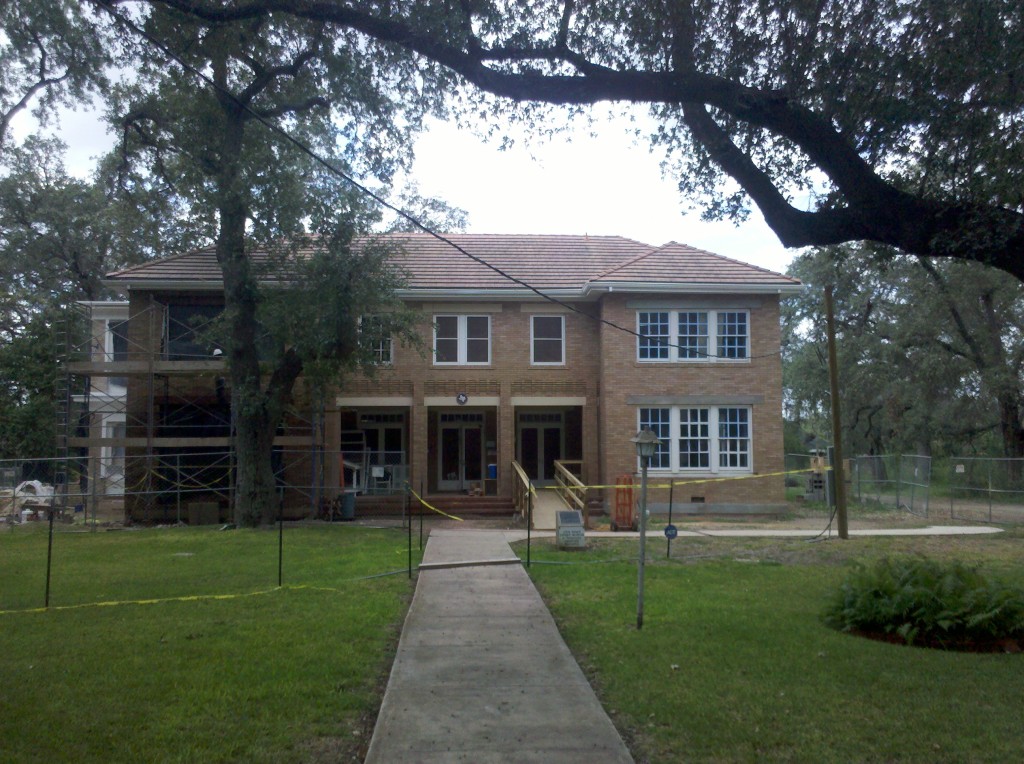
Photo of the John Nance Garner Museum in Uvalde, TX.  There were lots of nice homes in Uvalde, which bills itself as Tree City, USA.  Indeed there were many trees planted there and several were growing in the middle of streets.

Photo of the John Nance Garner Museum in Uvalde, TX. There were lots of nice homes in Uvalde, which bills itself as Tree City, USA.  Indeed, there were many trees planted there and several were growing right in the middle of streets.

The drive along the Map4 route was very hilly, since it is part of the Texas Hill Country.  The roads were very narrow and mostly free of any traffic, but there are also lots of twists and turns and with a speed limit of 65 mph, I think cars might be right on top of us before we could have a chance to react.  So I am not at all opposed to Tim mapping out an alternative route to at least some of the Southern Tier Map 4, even though it is not his turn to plan the route.  We’ll see what he comes up with – we have a few moths to decide on the route we’re going to take in early March 2014.

We made it to our hotel near the San Antonio Airport around 5:00pm, had a few beers and snacks, and then Tim drove us to downtown San Antonio for a visit to the Alamo and the River Walk.

Beth in front of the Alamo, San Antonio, TX.

Beth in front of the Alamo, San Antonio, TX.

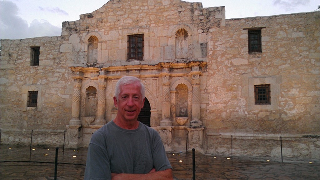
Brian at the Alamo.

Brian at the Alamo.

After an outstanding steak dinner at the Saltgrass Steak House on the River Walk (great choice Tim!), we finally managed to get Beth to at least try on a cowboy hat, even if we couldn’t interest her in letting us buy it for her.
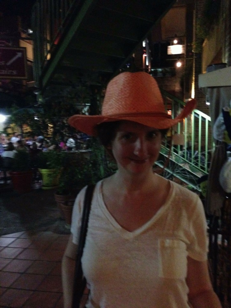
Beth posing in a cowboy hat on the River Walk in San Antonio, TX.  Maybe on our next leg, we'll convince her to buy one. :)

Beth posing in a cowboy hat on the River Walk in San Antonio, TX. Maybe on our next leg, we’ll convince her to buy one. 🙂

All in all, it was a long but nice day, and a great way to end Leg 3!

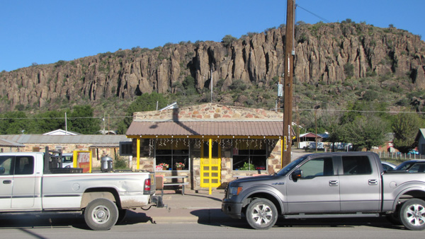
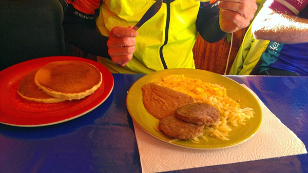
We all had breakfast at Johnny B’s, a cute retro greasy spoon next to the hotel. The TV in the corner had the Today show on, with its dumb stories about how you’re allowed to eat food past the expiration date and how Miley Cyrus had teased Matt Lauer about his sex life. It seemed incongruous to me that this part of Texas would be exposed to the same cultural junk as the rest of America, because it kind of does feel like a different country here. TV in west Texas should only have stations with shows about ranchers and trucks and Mexicans, at least while I’m visiting. And all the good John Wayne movies plus Touch of Evil should be running on a loop. 

05-01

You can tell Brian is in a good mood from his jaunty pose

05-03

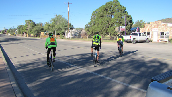
I feel obligated to post these pre-ride photos even though they all look pretty much the same. You guys need to start mixing it up a little with different expressions or poses.

I really (really) didn’t want to leave the Gage Hotel, especially knowing that the Outback Oasis in Sanderson, self-proclaimed Cactus Capital of Texas, was our next stop.

I contemplated getting an expensive massage, but that would have been rubbing it in too much. So I picked out an overstuffed chair in the lobby next to the fireplace and caught up with work for a few hours.

05-05

I’ll miss you, Gage Hotel and taxidermy friends

05-04

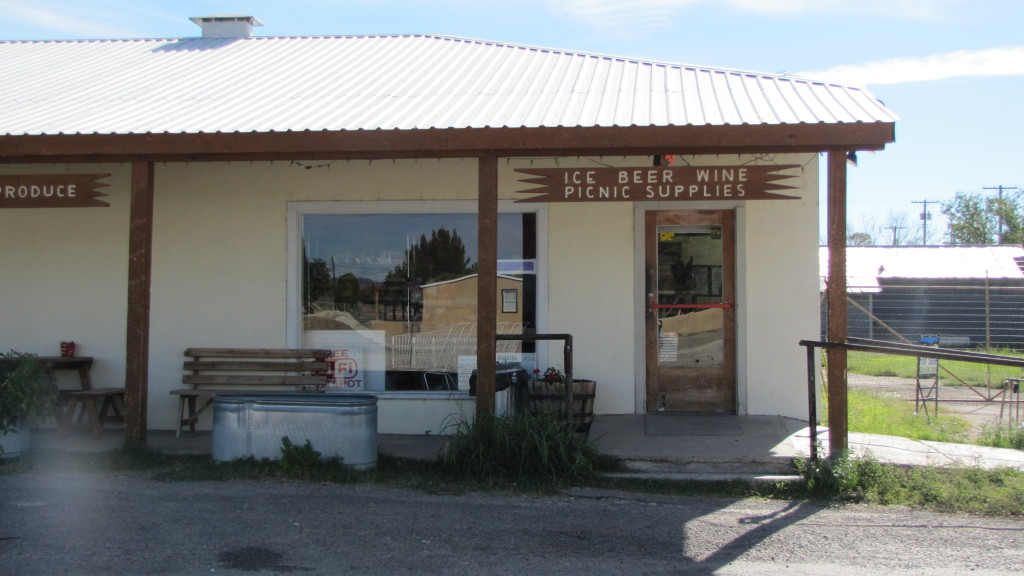
The French Grocer, Marathon, Texas, featuring very expensive Gatorade

The dudes wanted to add 30 miles to their total today so that they wouldn’t have a crazy-long ride on Wednesday. I picked them up at a picnic area on highway 90 and reluctantly trucked them back to the Outback Oasis.

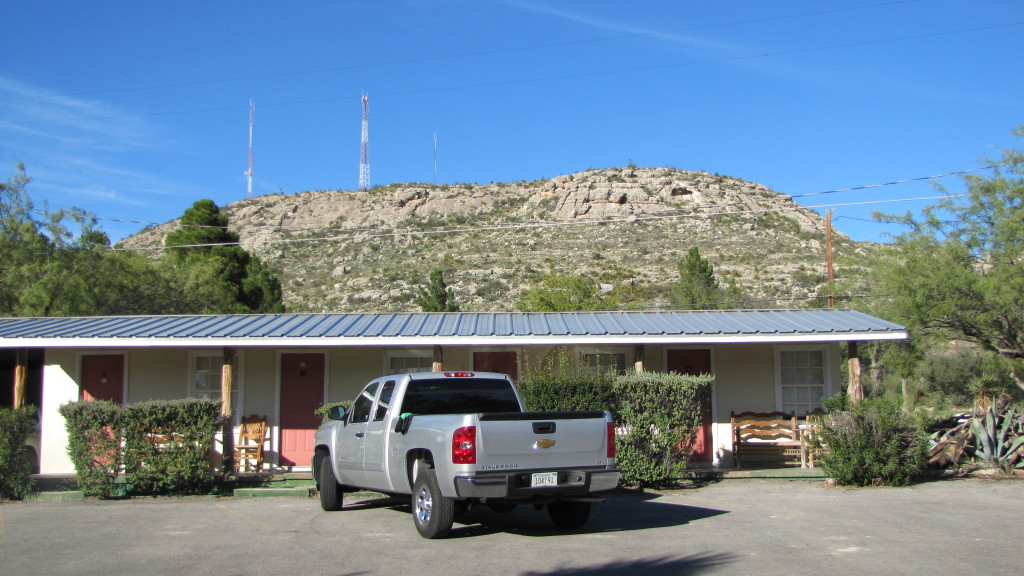
It’s a charming motel on the outside, and the owners seem like very nice people. The reviews online all say things along the lines of, “It’s nothing special, but it’s clean.” But it actually wasn’t clean. There was a piece of tortilla chip on my comforter, confirming my fear that comforters rarely get washed (which I usually just try not to think about because ugh). The grimy bathroom floor was one big ant party, with a conga line (credit Mark for the phrase) starting in the shower. The crappy mattress creaked with every small move and the stained barcalounger had no springs left. In the span of a few hours we’d gone from first to worst in Brothers’ Bike Ride accommodations.

05-06

Silver had no complaints

05-07

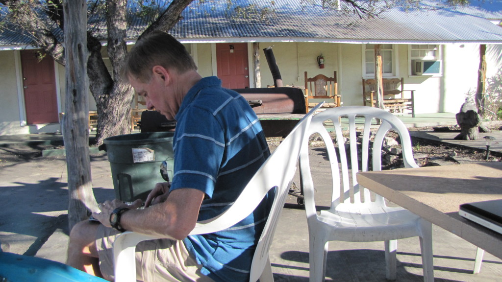
The internet worked outside, at least

For dinner we alighted on the Eagle’s Nest, which seemed to be the only open establishment. The woman who waited on and cooked for us and who probably owned the place told us about how Sanderson (population 837) was hurt when the train switching stations moved from there to Alpine. It’d be interesting to see what Sanderson is like in 50 years, if it still exists. I had chicken tenders (my go-to meal when I don’t know whether to a trust a place), and the guys had burgers, all with tater tots on the side. The food was fine. The brothers reminisced about family trips they took when they were kids and I ate it all up.

05-08

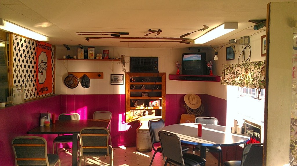
It’s hard not to like a place that embraces fuscia

05-10

Texas tableau

05-09

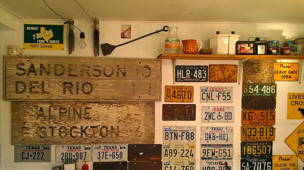
Old license plates are never a bad decor idea for a restaurant (seriously)

Back at the motel, I really tried to sleep, but I was skeeved out for various reasons. There were no curtains, just blinds, and I realized that I could easily be seen through the window if I slept too far over on the right side of the bed. I kept thinking I heard subtle movements just outside my door, but when I got up to look, nothing was there. The ants continued to party, and I pictured them conga-ing right up onto my arms and legs.

I finished one book and read five chapters of another. Some time after 1 a.m. I finally conked out.

Hotel Art of the Day

05-11

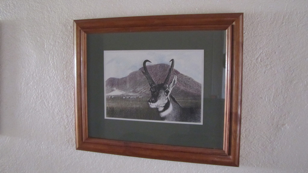
An antelope
~11″x7″
Outback Oasis Motel, Sanderson, Texas

Hotel Art Score

6/10. There were three related pencil drawings in my room and I enjoyed all of them. They appear to be originals and were done by someone with some amount of talent. I chose this one because the antelope seems to be photobombing the mountainscape and it amused me. The color feels like an afterthought, though; it almost seems like a kid went in and colored someone’s illustration. It would be more successful if it were black and white.

Art Art Score

It’s essentially folk art. I don’t know. 3/10?

Friday October 11, 2013, 31 miles (50 km) – Total so far: 464 miles (746 km)

Eight straight days of bike riding are over and while feeling the need for rest, I feel a great sense of accomplishment. It was another great trip and all of our careful planning worked out. Overall, beautiful roads, comfortable hotels, delicious meals, very courteous drivers and friendly people along the way made this third leg of our journey equally as memorable as the first two. Texas has been a pleasant surprise for me. I have never really spent much time in the Lone Star State but discovered that Texans are rightfully proud of their enormous state. Although there was not the spectacular view from the top of Emory pass, or the view of the Pacific Ocean, it possesses its own type of desolate beauty. I look forward to two more weeks in the future to complete the ride all the way across Texas and into Louisiana. We were dropped off by the Sag Wagon in Bracketville and rode west for this short segment. We needed to dis-assemble our bikes and check out of the Hampton Inn by noon and then drive to San Antonio for our flight home. We reckoned (localism) that it would be safer to ride west at sunrise because the angle of the sun is directly in east bound drivers eyes, making that direction a bit hazardous for bike riders on the shoulder. We packed the car and left Del Rio around 7 a.m. Sunrise was 7:38 this morning. Unfortunately we got lost in the dark and almost drove right into Mexico. It turned out to be an overcast day and we had our first rainy ride (just a short drizzle, thankfully). This section is on the ACA map # 4 so we did get a little closer to San Antonio. For something completely different, I didn’t get a flat tire…good way to finish!
The border fence in Del Rio. We didn't want to go that way.

The border fence in Del Rio. We didn’t want to go that way.

Rt. 90 west bound between Bracketville and Del Rio. A few minutes of drizzle and then it cleared up somewhat. The chip seal surface was especially rough until we crossed back into Val Verde County.

Rt. 90 west bound between Bracketville and Del Rio. A few minutes of drizzle and then it cleared up somewhat. The chip seal surface was especially rough until we crossed back into Val Verde County.

Trainer plane landing at Laughlin Air Force Base. The shoulder is smoother than the road here.

Trainer plane landing at Laughlin Air Force Base. The shoulder is smoother than the road here.

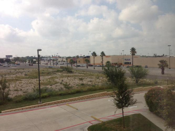
The view of a mall in Del Rio from the Hampton Inn.

The view of a mall in Del Rio from the Hampton Inn.

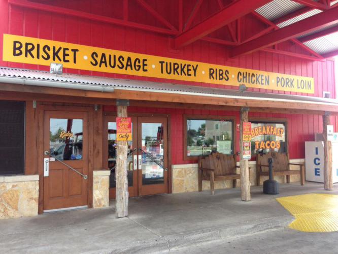
Rudy's Barbecue. We had dinner and lunch here. Great barbecue.

Rudy’s Barbecue. We had dinner and lunch here. Great barbecue.

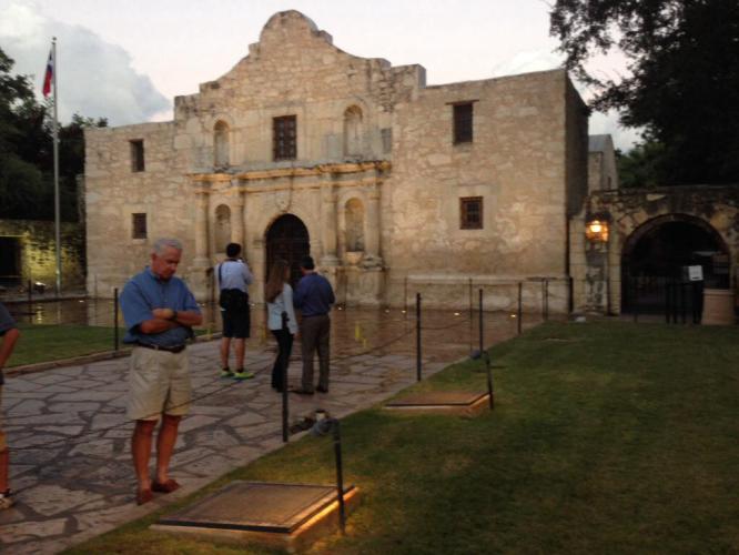
The Alamo in San Antonio.

The Alamo in San Antonio.

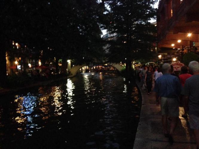
We had dinner on our last night at The Salt Grass Steakhouse on the River Walk.

We had dinner on our last night at The Salt Grass Steakhouse on the River Walk.

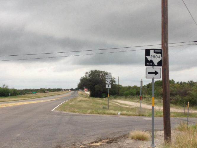
Our starting point for next year's ride.

Our starting point for next year’s ride.

Thursday October 10, 2013, 30 miles (49 km) – Total so far: 433 miles (696 km)

After all, the Brothers Bike Ride is about having fun. Yesterday was a blast…just not the fun kind of blast. The wind wrestled us to the ground in Comstock and we gladly cried uncle. Unfortunately, Tim is still feeling the effects of the half-Nelson wind strangle hold, and he elected to forgo today’s ride in order to ward off really getting sick. This morning at 8:30 a.m., Brian and I (at Tim’s urging) began to ride the last 30 miles of Leg 3. However, Ruth (our mother) didn’t raise no dummies, and we rode with the wind at our back and believe me when I say a song in our hearts! We followed Horace Greeley’s advice and went west, young man, riding back to Comstock from our hotel in Del Rio. Going west towards Comstock is uphill, but with 20 mph tailwinds, it made for quick, quiet, enjoyable riding. We had a blast—the good kind. Even another flat tire (me again! What’s up with me and flats?) didn’t diminish our elation because compared to yesterday, we felt like we were flying. We will wait and see if tomorrow Tim feels well enough to ride. Maybe we could still make it to Uvalde and be a little closer to San Antonio. If not then that is okay. The Brothers Bike Ride will return, to be continued…

Approaching the Amistad National Recreation Area. Today was the first time we had to deal with any humidity on any of the rides all the way back to San Diego.

Approaching the Amistad National Recreation Area. Today was the first time we had to deal with any humidity on any of the rides all the way back to San Diego.

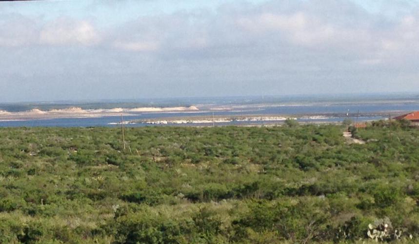
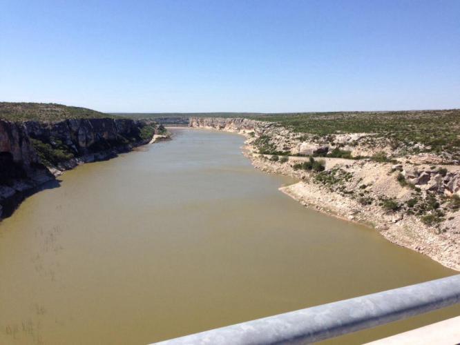
Another shot of the Amistad Reservoir at the confluence of the Rio Grande, the Devils River, and the Pecos River. Spanish for "friendship", it is located on the U.S. And Mexican border.

Another shot of the Amistad Reservoir at the confluence of the Rio Grande, the Devils River, and the Pecos River. Spanish for “friendship”, it is located on the U.S. And Mexican border.

0703

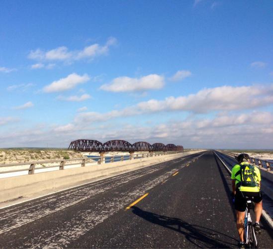
Another one handed courageous camera shot taken on the 2 mile long, very narrow and extremely hazardous bridge on Rt. 90. Notice that there are no shoulders. Only inches to spare if two vehicles overtake us at the same time. The lengths I go to so you people can vicariously enjoy beautiful photography. You are welcome. No cars passed us on the entire length. It was actually a really fun bridge to cross. That is a railroad crossing to the left.

Another one handed courageous camera shot taken on the 2 mile long, very narrow and extremely hazardous bridge on Rt. 90. Notice that there are no shoulders. Only inches to spare if two vehicles overtake us at the same time. The lengths I go to so you people can vicariously enjoy beautiful photography. You are welcome.
No cars passed us on the entire length. It was actually a really fun bridge to cross. That is a railroad crossing to the left.

This may well be the last picture of the unique vegetation we have enjoyed since El Paso.

This may well be the last picture of the unique vegetation we have enjoyed since El Paso.

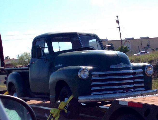
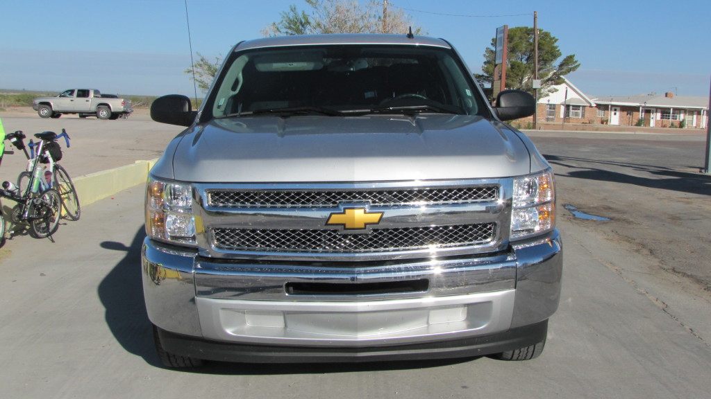
The grand daddy of "Silver," our Chevy Silverado pick up. Kevin or Ted, what year is this truck?

The grand daddy of “Silver,” our Chevy Silverado pick up. Kevin or Ted, what year is this truck?

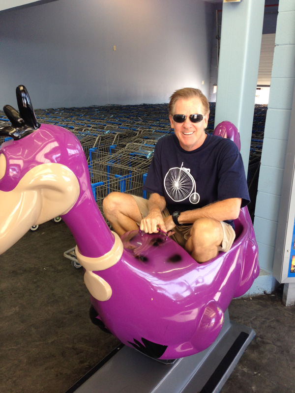
This is for you, Patrick. Looks like I won you $10. Ride 'em, cowboy!

This is for you, Patrick. Looks like I won you $10. Ride ’em, cowboy!


At breakfast this morning, Tim told Mark and me that the cold he’s been fighting the past few days has finally gotten the better of him and so he wouldn’t be riding with us this morning.  Mark and I decided to ride anyway, but to make an easy day of it by riding with the wind instead of against it.  We decided to ride from Del Rio back to Comstock, a distance of only 30 miles, heading west with the wind, instead of from Comstock, where we left off yesterday, to Del Rio heading east against the wind.  We missed Tim on our ride today – it was uphill most of the way, but it was only 30 miles, so it went relatively fast.

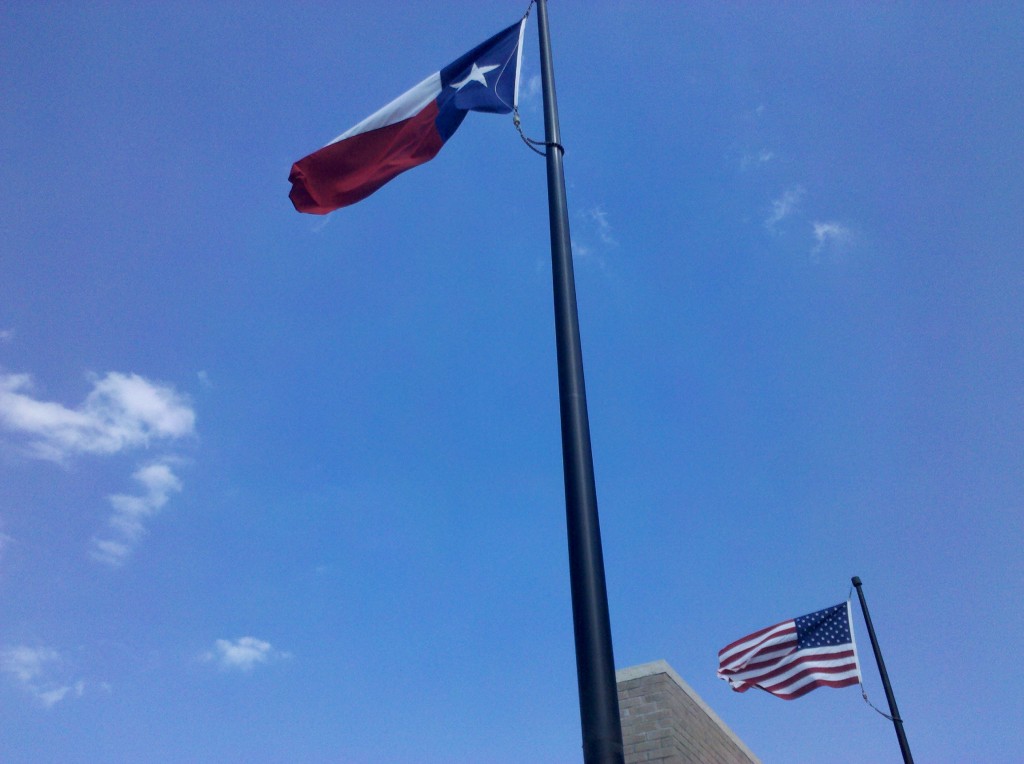
The first image I took a photo of today was of the flags of Texas and the U.S.  The flags were straight out and blowing in the direction we decided to travel, so it was a good omen.  Winds today were 15-20 mph with gusts up to 30 mph out of the east.  It would have been another hard ride if we opted to go against them, but we didn’t.

Texas and U.S. flags blowing in the direction we rode today.  Often in Texas, the state flag is somewhat larger than the U.S. flag (since Texas was a republic before it was a U.S. state), but these flags look to be the same size.

Texas and U.S. flags blowing in the direction we rode today. Often in Texas, the state flag is somewhat larger than the U.S. flag (since Texas was a republic before it was a U.S. state), but these flags look to be the same size.

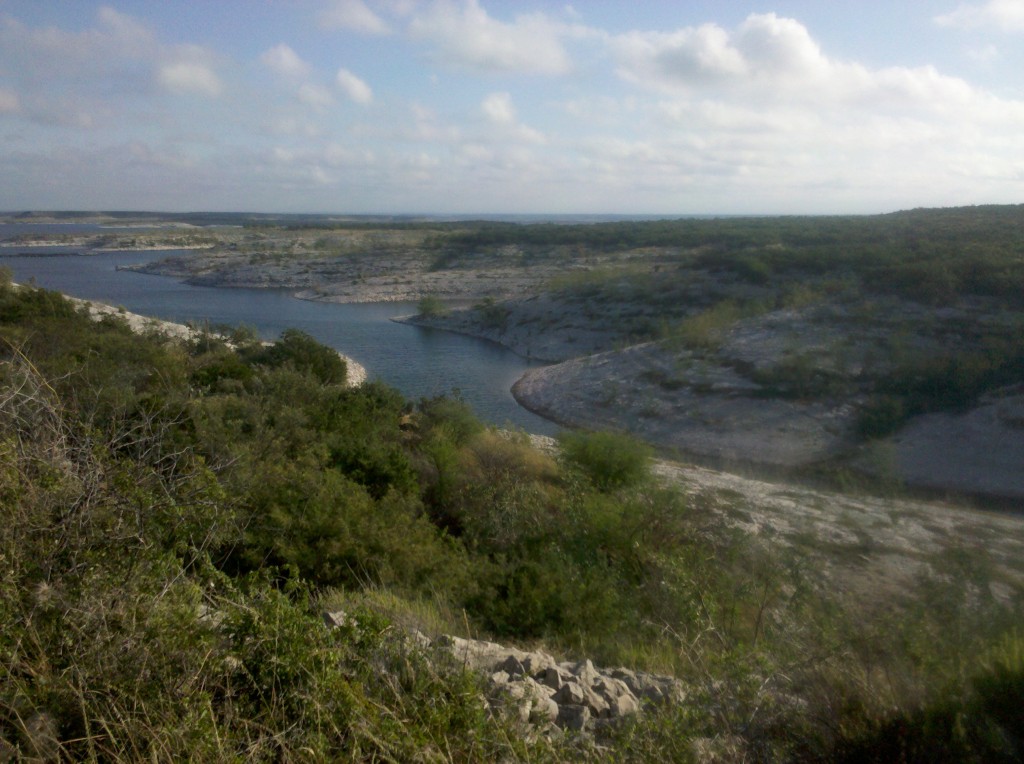
Just before we crossed over the Amistad Reservoir, Mark and I stopped to take a few pictures of this beautiful body of water.  It’s right next to a dam on the Rio Grande, and it fed by the Rio Grande and the Pecos Rivers.  It looks to be very high right now – we didn’t see any high water marks on the shore above its current level.

Close up view of the Amistad Reservoir on the east side along U.S. 90.

Close up view of the Amistad Reservoir on the east side along U.S. 90.

Mark taking a photo of Amistad Reservoir. It was another beautiful day, but we could feel the humidity today.

Mark taking a photo of Amistad Reservoir. It was another beautiful day, but we could feel the humidity today.

Mark and I were both a little concerned about crossing over the Amistad Reservoir on U.S. 90, since it is only a two-lane bridge with next to no shoulder whatsoever! But we were in luck, and also crossed it very early in the day.  Most of the traffic was headed in the opposite direction, towards Del Rio, while we were headed away from Del Rio.  So it was relatively easy, plus traveling with the wind allowed us to traverse the 2-mile long bridge very quickly.  But see for yourself in this next video.

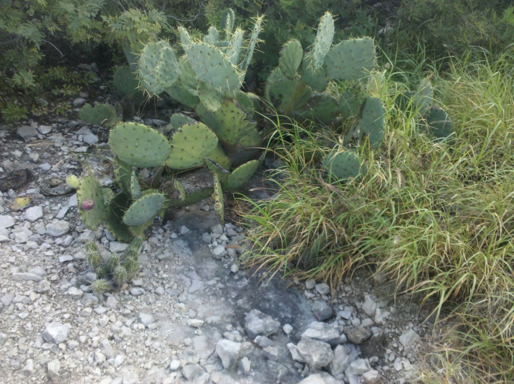
Once we crossed the bridge, we made a quick stop to phone Beth and ask her to meet us in Comstock at 11:00am.  We also took a few photos of the roadside vegetation.  Bet you can’t guess what I took some photos of …..  🙂

Prickly pear cactus photo #1 of the day.

Prickly pear cactus photo #1 of the day.

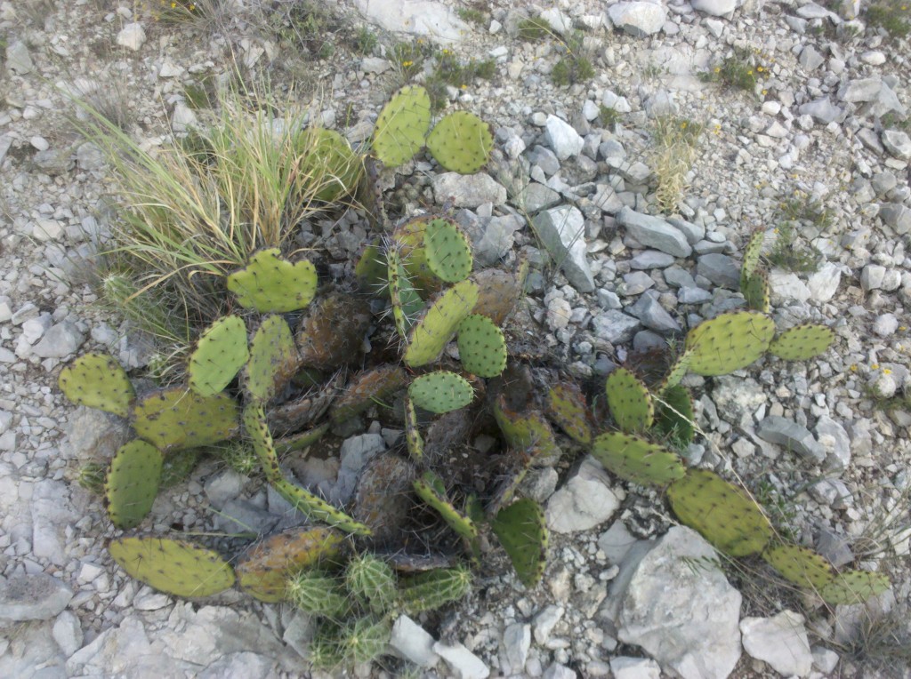
Prickly pear cactus photo #2 of the day.  Mark thinks these may be of the Teddy Bear variety and he may be right about that.

Prickly pear cactus photo #2 of the day. Mark thinks these may be of the Teddy Bear variety and he may be right about that.

The only unforeseen event of the day was that Mark got another flat tire, his third of this trip.  And this time if was my son Chris coming to the rescue.  He recommended that I take along a pump that he personally liked, and so I did.  Previously we had been using Tim’s pump but since he wasn’t with us, we used the pump Chris purchased for me and it worked fine!  So thanks Chris!

While we were changing the flat, the flies descended on us, finding us in less than one minute.  Mark and I agreed that the flies and other insects are the only thing about Texas that we’re not fond of – everything else about Texas (the history, the scenery, the courteous drivers and friendly people in general) have been great!  But the insects are another story.  They remind me of when my Dad was stationed in Texas during WWII and my Mom came down to live with him for a while.  I’m sure my sister Denise was with them also.  I remember my Mom telling me that the Texas insects were so pervasive, that aside from canned goods, every other food item had to be kept in the ice box to keep the insects from getting to it.  I can really understand why now.

But even with losing a little time changing the flat, we still made it to Comstock in time for Beth and Tim to pick us up at 11:00am.  Then it was a quick drive back to Del Rio, some relaxation in the pool and the hot tub, followed by a real Texas barbeque lunch, which was outstanding!  Beth, Mark and I decided we were going back there for dinner tonight!

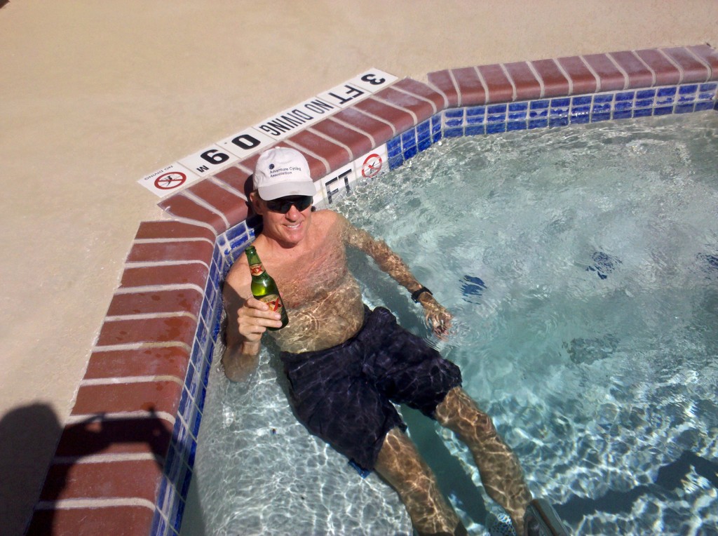
Mark enjoying a brewski at the Hampton Inn hot tub, Del Rio, TX.  Map 3 of the Adventure Cycling Association Southern Tier Route is now complete!  We're going to let Tim decide, based on how he feels on Friday morning, whether we ride tomorrow or not.

Mark enjoying a brewski at the Hampton Inn hot tub, Del Rio, TX. Map 3 of the Adventure Cycling Association Southern Tier Route is now complete! We’re going to let Tim decide, based on how he feels on Friday morning, whether we ride tomorrow or not.

Wednesday October 9, 2013, 60 miles (97 km) – Total so far: 402 miles (648 km)

The alarm went off at the same time, and we all met in the dark to pack the car with bikes and bags. We witnessed another beautiful sunrise as we began our cold morning ride in another West Texas town. It could be Fort Hancock, Van Horn, or Marathon—they are all running together as we work to accomplish this task of riding from El Paso to anywhere close to San Antonio. As beautiful as it is around here, it is beginning to look very much the same!

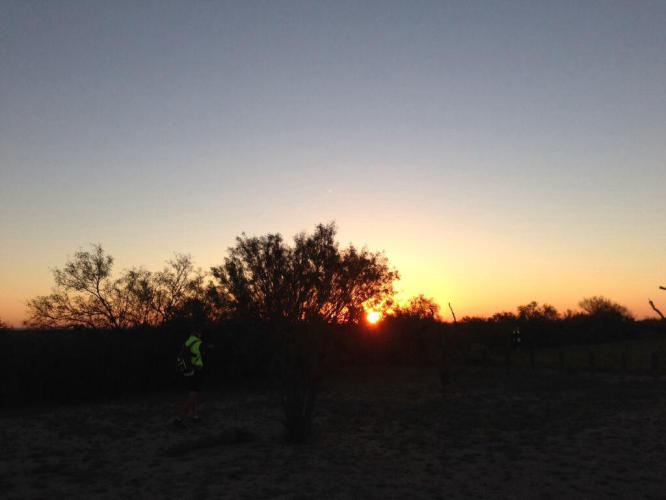
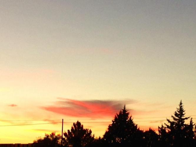
Sunrise at our drop off point picnic area on Rt. 90 about 5 miles east of Dryden.

Sunrise at our drop off point picnic area on Rt. 90 about 5 miles east of Dryden.

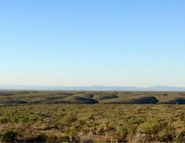
Another blue sky day in the cold morning air as we pedal along the expansive wide open range.

Another blue sky day in the cold morning air as we pedal along the expansive wide open range.

We had planned to ride 90 miles to Del Rio with an early morning start, hoping for at least a few hours of calm morning winds, but of course Mother Nature didn’t cooperate. We were forced to stop after 60 hard, long miles, making it only to Comstock. On this section, there are no services for many miles and there is no cell signal. Beth couldn’t track our progress and wasn’t surprised when we called for a pick up at 3:30 p.m.

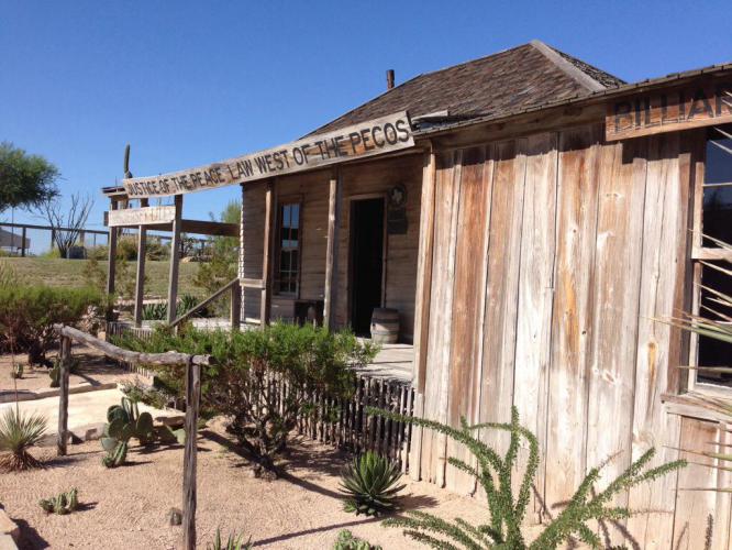
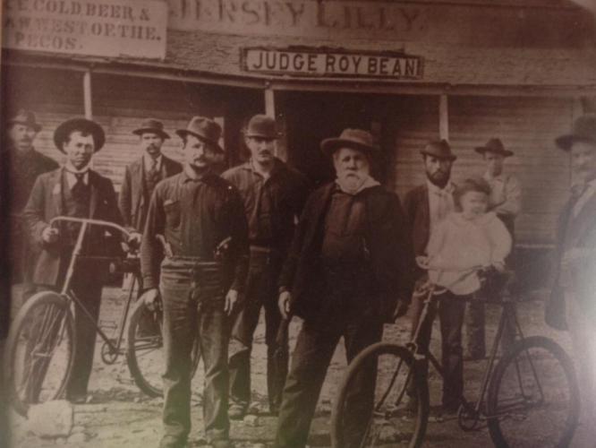
Langtry, TX is a ghost town with a visitor center and museum dedicated to Judge Roy Bean, the Law West of the Pecos. It was nice to find relief from the 15 to 20 mph headwinds.

Langtry, TX is a ghost town with a visitor center and museum dedicated to Judge Roy Bean, the Law West of the Pecos. It was nice to find relief from the 15 to 20 mph headwinds.

Judge Bean (in the center with the beard) and his bicycle club buddies.

Judge Bean (in the center with the beard) and his bicycle club buddies.

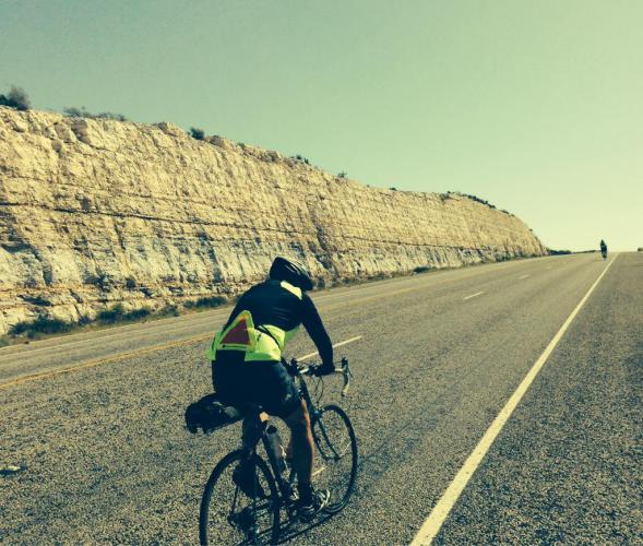
Long, steep rolling hills and headwinds made it a memorable day. (We won't remember the easy days.)

Long, steep rolling hills and headwinds made it a memorable day. (We won’t remember the easy days.)

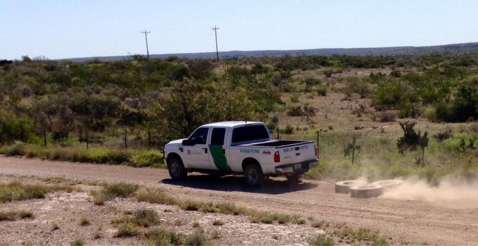
The border patrol drags tires to smooth the dirt and catch illegals leaving tracks. At least that is our guess what he was doing.

The border patrol drags tires to smooth the dirt and catch illegals leaving tracks. At least that is our guess what he was doing.

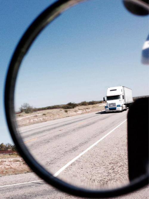
This is what I see in my mirror right before I yell to Tim and Brian, "Truck back!" Today I had to scream it due to the noise from the wind.

This is what I see in my mirror right before I yell to Tim and Brian, “Truck back!” Today I had to scream it due to the noise from the wind.

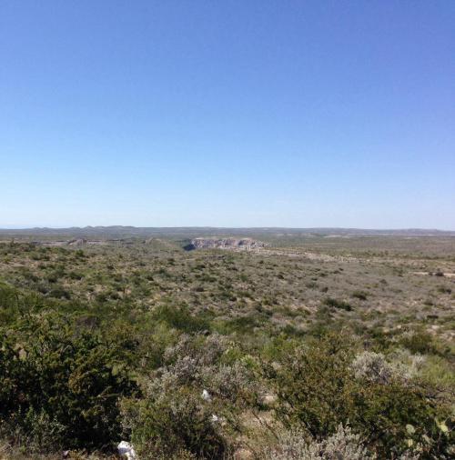
This was taken from a scenic overlook before we crossed the Pecos River and officially left west Texas behind. The Rio Grande and Mexico are out there in the distance. We took a break every chance we could as the day dragged on.

This was taken from a scenic overlook before we crossed the Pecos River and officially left west Texas behind. The Rio Grande and Mexico are out there in the distance. We took a break every chance we could as the day dragged on.

No break was taken to get this shot over the Pecos River. The river is 275 feet below the bridge. The crosswind was horrendous and I just held the handlebar with one hand and snapped away without taking my eyes off the road. Not a bad picture considering the circumstances. You won't see any images of the Pecos crossing from camera cowards Tim and Brian.

No break was taken to get this shot over the Pecos River. The river is 275 feet below the bridge. The crosswind was horrendous and I just held the handlebar with one hand and snapped away without taking my eyes off the road. Not a bad picture considering the circumstances. You won’t see any images of the Pecos crossing from camera cowards Tim and Brian.

We met John Chapman who is going Coast to Coast to benefit no-kill animal shelters. "Miles for Mutts." Search for his blog on crazyguyonabike.com.

We met John Chapman who is going Coast to Coast to benefit no-kill animal shelters. “Miles for Mutts.” Search for his blog on crazyguyonabike.com.

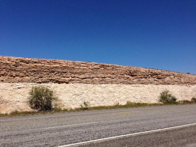
Interesting geology in the road embankment. We tried to stop between the walls for shelter from the wind but it didn't help very much.

Interesting geology in the road embankment. We tried to stop between the walls for shelter from the wind but it didn’t help very much.

I was expecting the truck to name itself, but it told me it’s just “the truck.” It’s a silver Chevy Silverado. So maybe its name should be Silver. But that seems a little wussy for something that looks like this:

Fine, truck.

Actually he kind of looks like he’s smiling from this angle

The top speed I’ve registered is 100 mph on a pass, and I didn’t even notice until I was back in my lane and slowing down. It is a smooth, smooth ride. And it’s really the perfect vehicle for this leg, because I fit right in with these Texas rangers. I would never want to own one of these, but it’s great to pretend I do for a week.

Mark decided on Monday that he didn’t want to ride from Marfa to Marathon because he’d seen it yesterday on the drive and it didn’t look fun. I thought he was joking at first because it can be hard to tell when Mark is being serious. He said he was half-serious, but actually he was all-serious. And Tim and Dad were fine with it. So I drove the guys to Fort Davis and we breakfasted with some other pickup drivers at Lupita’s Place, the only open restaurant.

04-01b

Silver’s buddies at Lupita’s Place, Fort Davis, TX

04-02

El Grande primary color breakfast

04-03

And they’re off

I stopped at a gas station and cleaned all of the kamikaze bugs off Silver’s windshield with glee, then headed back to the lovely Captain Shepherd House and spent a stupidly long time trying to get online. Internet and mobile service feel like basic American necessities, but in west Texas they’re hard to come by. The thing about the Captain Shepherd House, though, is that it makes you want to split yourself into three people so that you can enjoy a bunch of its rooms all at once. So I opted to forego connectivity and luxuriate in our lodging.

I parked myself in one of the comfy sitting rooms and read and wrote. A couple of hours in to my reverie, the front door of the house opened. I heard footsteps walk past my sitting room. Then I heard a loud fart, the fart of a person who thought she was alone.

She walked into the dining room, about fifteen feet away, directly in my line of vision, and yet she remarkably did not notice me. She turned on the candle chandelier over the table and looked at it admiringly, and I decided that not saying something would be weirder than saying something.

“I heard you fart,” I said. No, I actually said:

“Hi there. I just didn’t want to freak you out.”

She had no perceptible reaction, holding her gaze steady on the chandelier. I thought she might not have heard me. She was fiftyish and blond and put together in a tasteful Texan way, wearing a white shirt with ruffles down the front. After a few seconds she looked at me and said, “I’m sorry, I didn’t think anyone was here.”

“It’s okay,” I said.

“I’m with the hotel,” she said.

“I assumed.”

“I’m so sorry,” she said.

“It’s really fine,” I said.

Then she left.

04-04a

Hallway where farting incident occurred

04-06

Sitting room

Candelabra

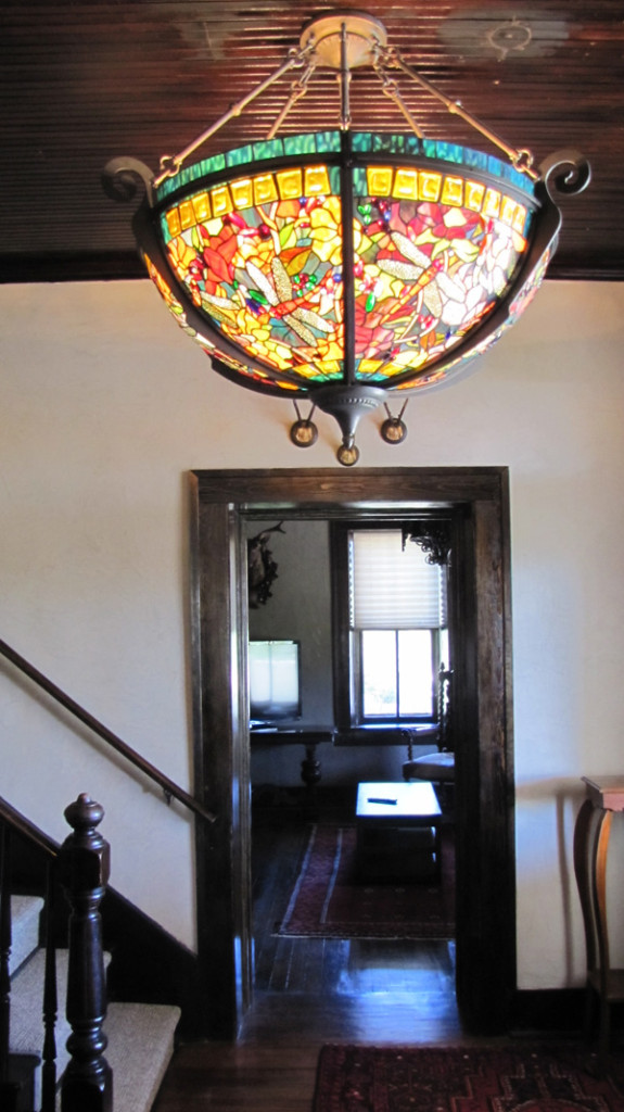
Candle chandelier

And some more shots of the place:

04-04b

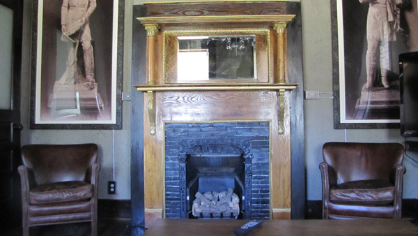
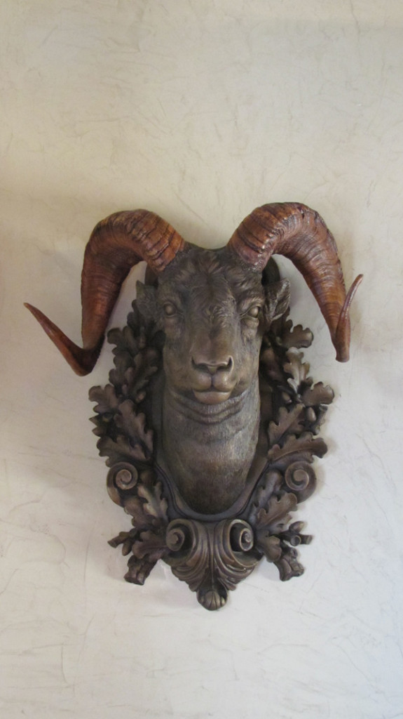
The Captain Shepherd House has the highest concentration of animal heads I’ve ever encountered

04-08

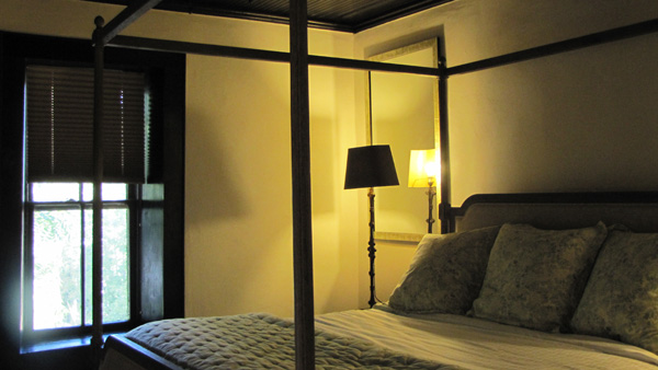
Boudoir

04-11

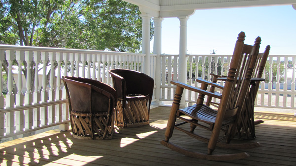
Porch we unfortunately didn’t use

04-09

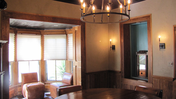
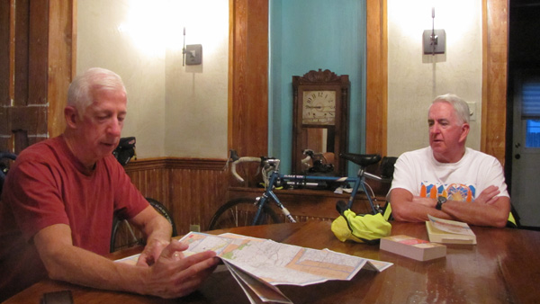
Planning the next day’s route at the roundtable

Hotel Art of the Day

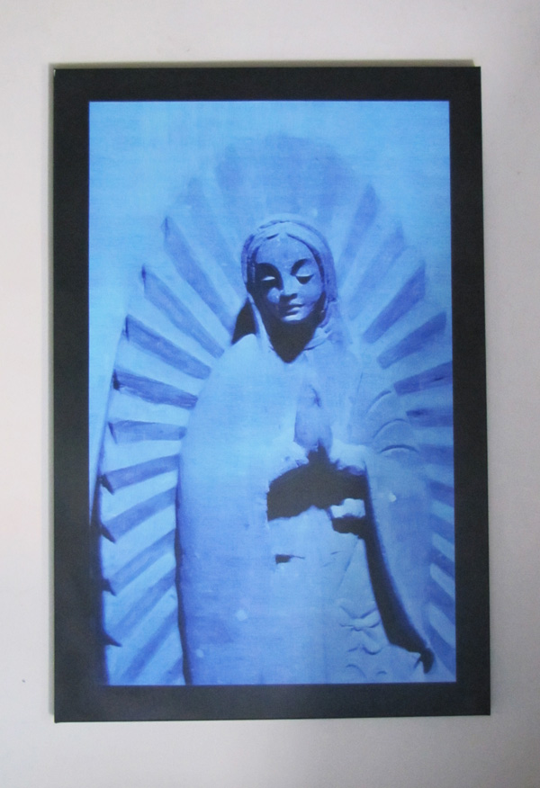
04-10

Blue Madonna
~18″x30″
Gage Hotel, Marathon, TX

Hotel Art Score

9/10. It’s kind of ballsy to put this in someone’s bedroom. The piece is both pretty and haunting.

Art Art Score

God, I don’t know. 6/10? The more I look at it the more meaning I find (or create for myself). It’s a photograph of a statue of the Blessed Mother, tinted blue. If you want to be moved by it spiritually, that’s there for you — it’s a striking, powerful image — but if you want to see it as a statement about the hollowness of religion, or of religious symbols, I think that’s there, too. And surely more. Go loco.

Not much you can say about relentless headwinds other than “they suck”. We had high hopes for today but all things considered, we did pretty well. Unfortunately, same forecast for tomorrow. I am fighting off a cold, so I’m a little under the weather. Got a lousy night’s sleep last night. Can’t wait to turn in tonight. I feel like I can beat it if I can just get a good night’s sleep.

The plan, at this hour, is to finish today’s ride tomorrow. 30 more miles to go in the ferocious headwinds/crosswinds. Gusts were getting up to 30 mph. It was a tossup whether the headwinds beat out a 30 mph crosswind gust or vice versa. We were really getting blown around. At least we are in a nice motel tonight and not a dump again.

Today we got up shortly after 6 am, packed up the truck, and drove off the lot of the Outback Oasis motel, which was easily the worst accommodations we have stayed in this or any leg of the bike trips.  The bugs at the Outback Oasis, flies, ants, etc. might have enjoyed it, but not us.  Mark was somehow able to tune them out, but I was not and neither was Beth.  After a really good breakfast taco (bacon and eggs on a soft corn taco), we started the 30 mile drive past Dryden, where Beth picked us up at the end of the day yesterday.  Here are two videos I took early this morning, one on the drive to our drop-off point, and one shortly after starting out on our ride.  It’s pretty dark in the first video, but you can see the headlights from our Silverado pickup truck, and the white line forming the edge of the eastbound lane of US 90.

We had ambitious plans for today!  We wanted to bike 92 miles from 10 miles east of Dryden all the way to Del Rio.  But, unfortunately, the wind had other plans, which you can kind of get a feeling for from the last video.   I think about the time we were 30 miles out and pulling into Langtry, TX, we realized that we weren’t going to make it.  The winds were a steady 15-20 mph with gusts up to 30 mph, and they were mostly headwinds.  Once we crossed the Pecos River, the winds became a combination of head and cross winds, and they were relentless, not to mention discouraging.  It was all we could do to pedal between 8-10 mph on the flats.  When we were riding uphill, and there were a ton of hills today, we were moving at a 5-6 mph clip.  So after having traveled 30 miles in more than 3 hours, it was likely going to take us until sometime after 6pm if we continued to Del Rio.  So we opted to make it to Comstock, another 30 miles away, and have Beth pick us up there, which she did at 3:45pm.  Our average speed for today was under 10 mph.  Oh well ….

Aside from the wind, the day was nice.  It was sunny, and it warmed up from the 54 degrees we started with all the way up to 85 degrees by the time Beth picked us up in Comstock.  Traffic along US 90 was fairly light and 99% of the drivers were extremely courteous, moving all the way over to the left when they passed us.  Like most of US 90, the stretch between Sanderson and Comstock was just 2 lanes total, but with a speed limit of 75mph.

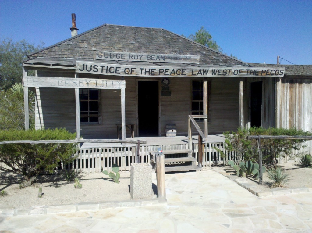
For me, the highlight of the day was our visit to the Judge Roy Bean Visitor Center in Langtry, TX, just a mile off of US90 on TX Spur 25.  There they tell the history of Judge Roy Bean, the law west of the Pecos.  His buildings are still there, restored no doubt but shown in the condition in which he occupied them.  The bonus part of the visit was the Judge Roy Bean cactus garden! Here are some photos from our visit.  If you’re ever in west Texas driving along US90 west of the Pecos River, don’t miss it!

Judge Roy Bean Courthouse, Langtree, TX.  This free historic attraction, offered by the Texas Department of Transportation, Travel Information Division, is well worth of visit!

Judge Roy Bean Courthouse, Langtry, TX. This free historic attraction, offered by the Texas Department of Transportation, Travel Information Division, is well worth of visit!

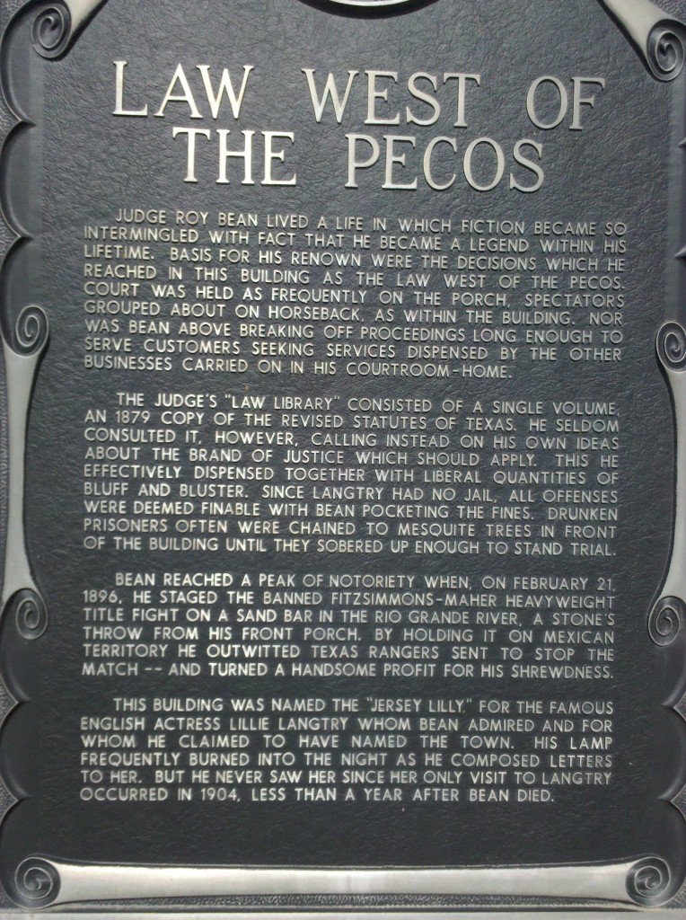
This historic marker at the Judge Roy Bean Visitor Center in Langtree, TX, tells more of his story and his shrewdness, especially when it came to making a buck!

This historic marker at the Judge Roy Bean Visitor Center in Langtry, TX, tells more of his story and his shrewdness, especially when it came to making a buck!

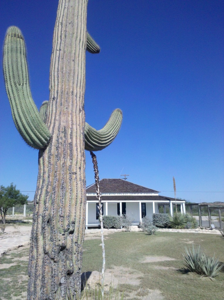
Saguaro cactus in Judge Roy Bean Visitor Center, Langtry, TX.  The only saguaro cactus we have seen on Leg 3 have been at Langtry.

Saguaro cactus in Judge Roy Bean Visitor Center, Langtry, TX. The only saguaro cactus we have seen on Leg 3 have been at Langtry.

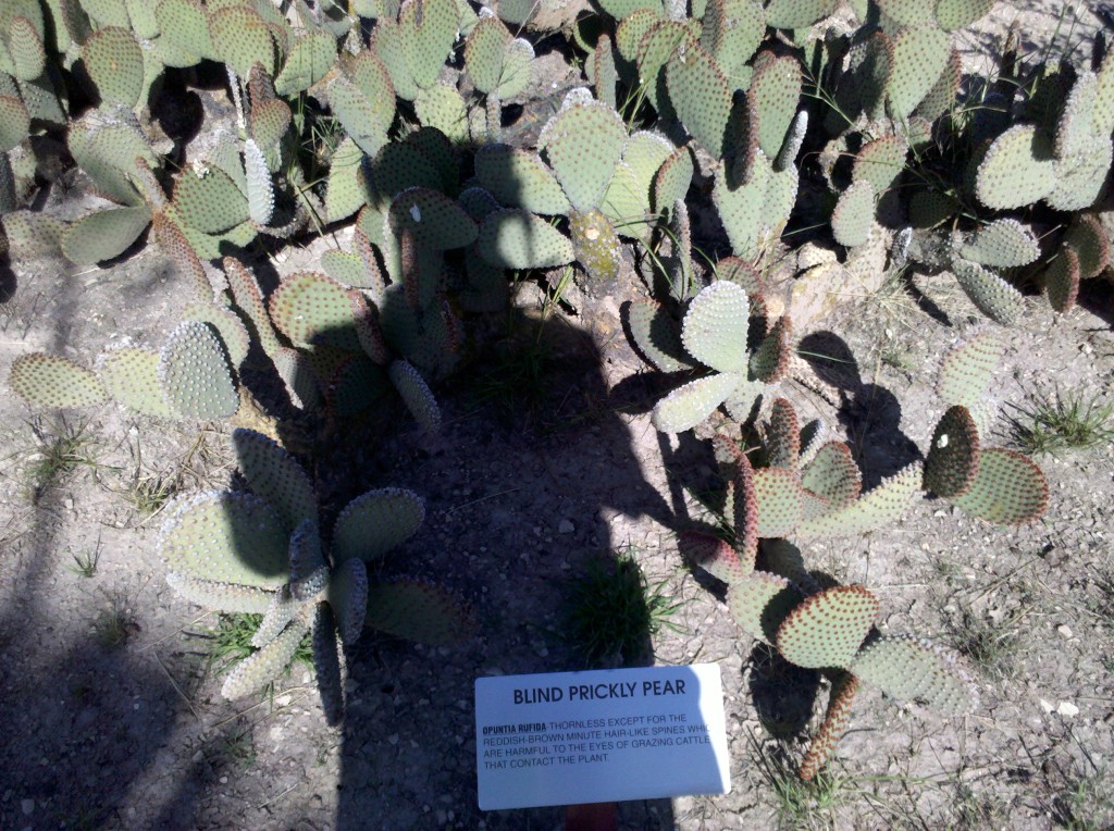
"Blind" prickly pear cactus in Judge Roy Bean cactus garden, Langtry, TX.  I'm really going to miss seeing prickly pear cactus every day ....

“Blind” prickly pear cactus in Judge Roy Bean cactus garden, Langtry, TX. I’m really going to miss seeing prickly pear cactus every day ….

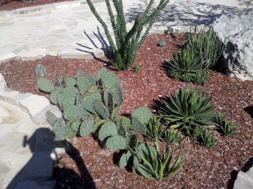
Prickly pear, Ornamental Agave, and Ocotilio cactus in Judge Roy Bean cactus garden, Langtry, TX.  Mark and Tim were getting a bit concerned that they'd have to remove me by force from the cactus garden! :)

Prickly pear, Ornamental Agave, and Ocotilio cactus in Judge Roy Bean cactus garden, Langtry, TX. Mark and Tim were getting a bit concerned that they’d have to remove me by force from the cactus garden! 🙂

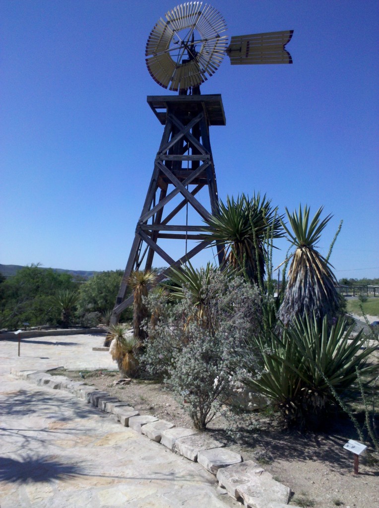
Windmill in Cactus Garden at Judge Roy Bean Visitor Center, Langtry, TX.

Windmill in Cactus Garden at Judge Roy Bean Visitor Center, Langtry, TX.

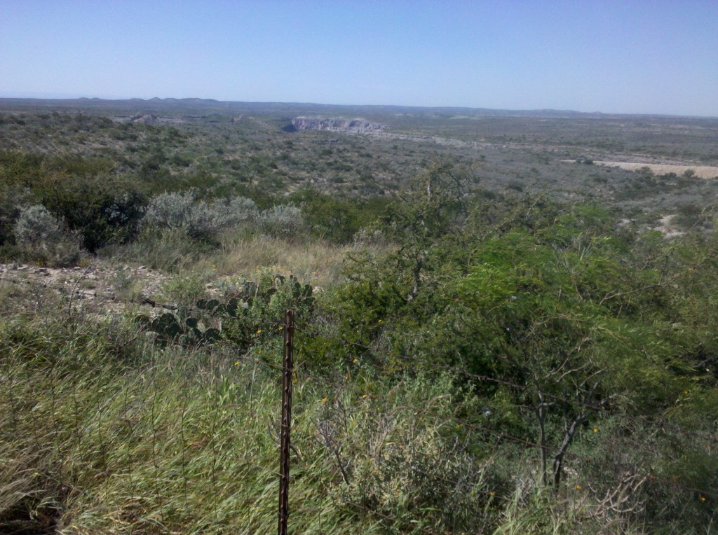
Gorge just west of Pecos River.  This was my only "scenic" shot of the day, but Mark took lots of them on the ride.

Gorge just west of Pecos River. This was my only “scenic” shot of the day, but Mark took lots of them on the ride.

The only other remarkable thing about today was the omnipresence of Border Patrol personnel.  I think we must have seen at least one vehicle every 30 minutes on the ride today.  Here is a video of a Border Patrol vehicle driving next to US 90 on a kind of a frontage road, except that it is gravel and not paved.  The vehicle is dragging three big tires behind it, which are sweeping the surface of the gravel road clean of any footprints.  It’s a little difficult to see the tires, but they are there in the very bottom right of the screen.  By sweeping the road, the next time they drive the road, probably early tomorrow morning, they’ll know if any people came along or over the gravel roadway.  We’re just a few miles from the border with Mexico, and within 40 miles from Del Rio, which is on the Rio Grande and right next to the Mexican border.

We’re having dinner at Chili’s (the best that Del Rio has to offer) and deciding what we’re going to do on tomorrow’s ride.  We’ll let you know tomorrow what we decided to do.  Bet you just can’t wait! 🙂

The only other thing I want to mention tonight is that I am reading a book loaned to me by Mart Lou Brogan, one of Nancy and my friends from our college years.  It’s called “The Given Day,” by Dennis Lehane.  It’s a very enjoyable read and I’ve been talking about it during almost all of our meals, but Beth, Tim and Mark might all want to read it, so I can’t give away any of the plot.  When I finish reading it, either on the plane home or possibly even before, I’m going to miss it.  It’s 700 pages long, but it’s moving very quickly.  So thanks Mary Lou, if you’re reading this!

Tuesday October 8, 2013, 86 miles (138 km) – Total so far: 342 miles (551 km)

Sunrise this morning in Marathon.

Sunrise this morning in Marathon.

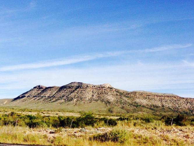
More Texas eye candy. A very beautiful part of this great country.

More Texas eye candy. A very beautiful part of this great country.

Tim flying downhill before our first coffee break.

Tim flying downhill before our first coffee break.

Another day at the office.

Another day at the office.

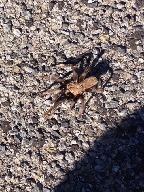
A tarantula looking for something to eat. We have noticed quite a few of these critters but it is hard to get one to pose for a snapshot. We also saw elk and deer and of course lots of cattle.

A tarantula looking for something to eat. We have noticed quite a few of these critters but it is hard to get one to pose for a snapshot. We also saw elk and deer and of course lots of cattle.

Today’s ride was blissful. We lost about 1500 feet or more of elevation. The wind was negligible for the most part, and we encountered very light traffic, beautiful blue skies, and warm temperatures. It was an easy 85-mile day. We are in Sanderson, TX, at the Outback Oasis Motel. It sure isn’t the Ritz, but it will do fine. Tomorrow we plan to make it to Del Rio.