Archives

All posts for the month March, 2013

We left Safford, AZ at about 7:45 a.m.  It was only 39 degrees but sure to warm up quickly so, for a change, I did not put on any extra layers and did not regret it.  Here is a video of us at we first started out.  Based on some comments about the videos, I tried to narrate them today, as much as I could.
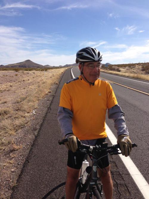
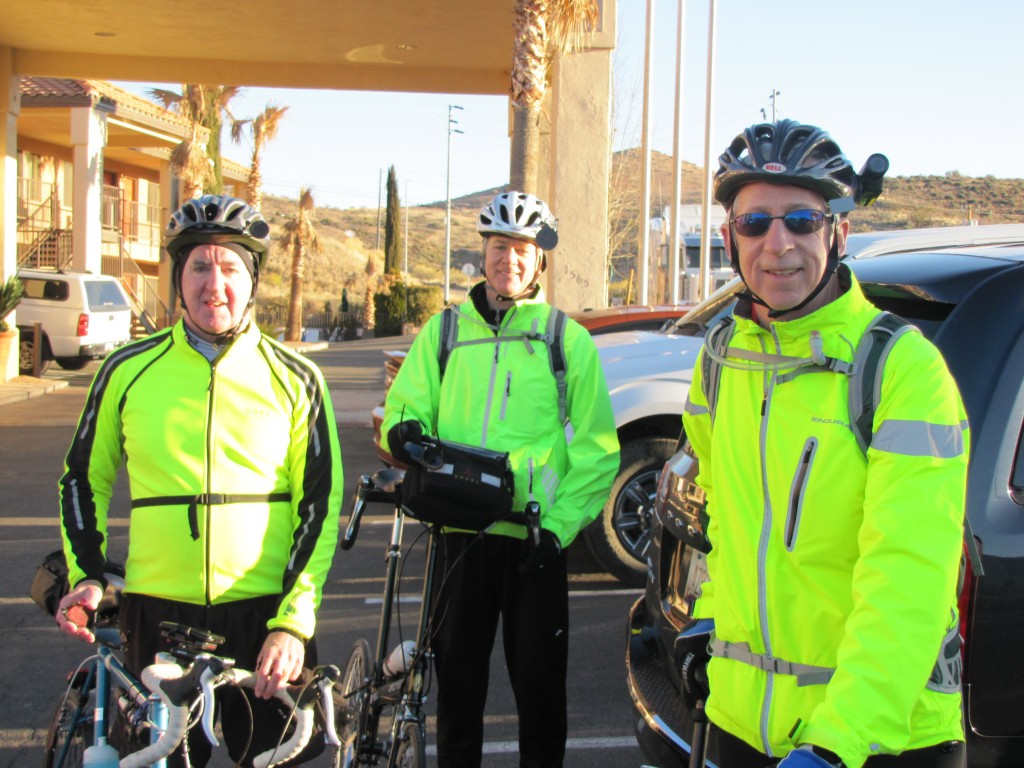
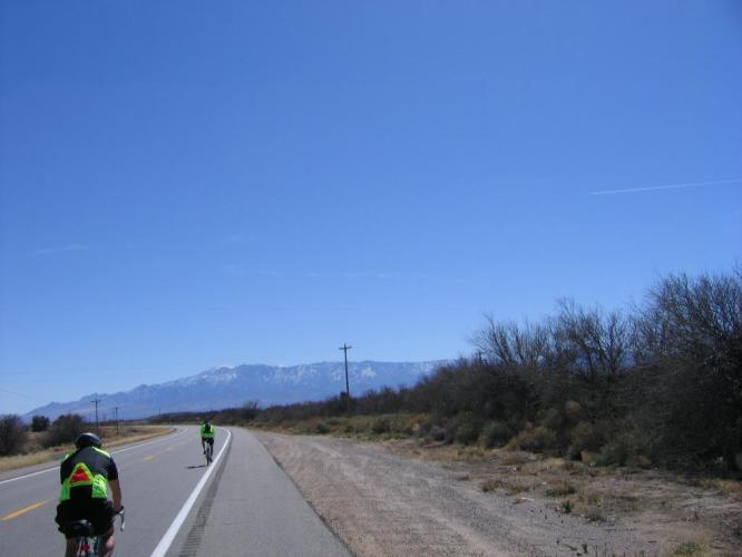
[vimeo clip_id="60967644" width="620"]

As usual, we made our first stop about an hour into the ride.  Here’s a shot of Tim at that rest stop, which was about 12 miles into the ride.  Notice the hat under his helmet and the long pants.  We have all gotten quite sunburned on our legs, so Tim kept those pants on the entire ride, even though it eventually warmed up to about 75 degrees today.

Tim at first rest stop along U.S. 70, 12 miles outside Safford, AZ.

Tim at first rest stop along U.S. 70, 12 miles outside Safford, AZ.

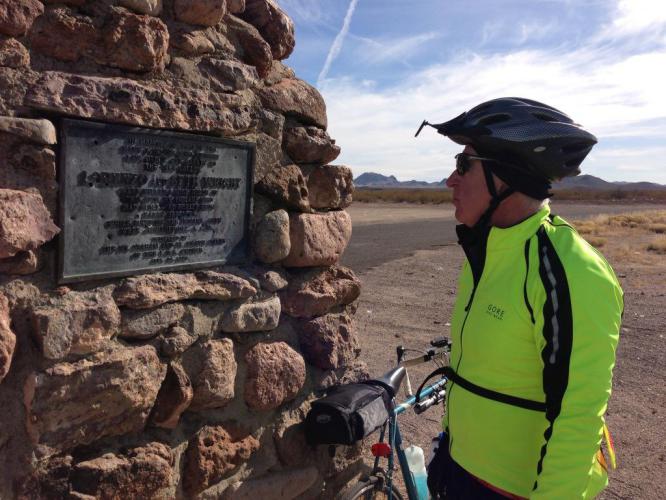
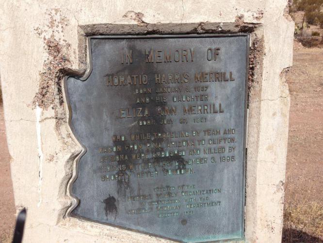
Our next stop was at a historical marker erected by members of the Church of the Latter Day Saints, in memory of two of their congregation who were killed by Indians who had stolen 45 of their horses.  Listen as Tim (yes, Tim, believe it or not!) reads from the words on the historical marker.
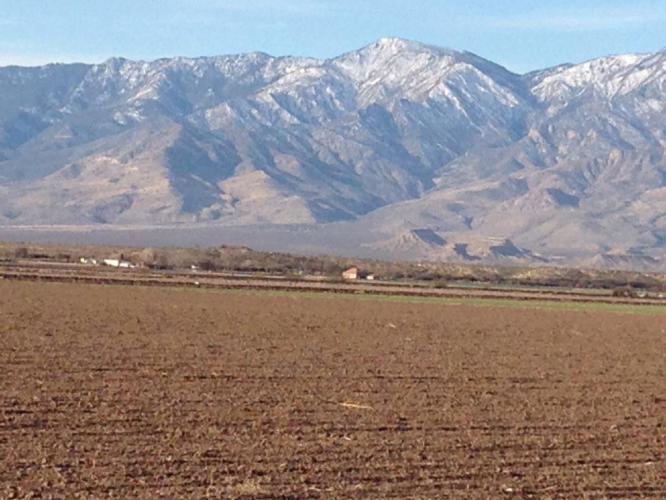
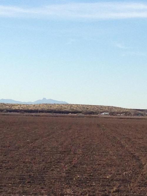
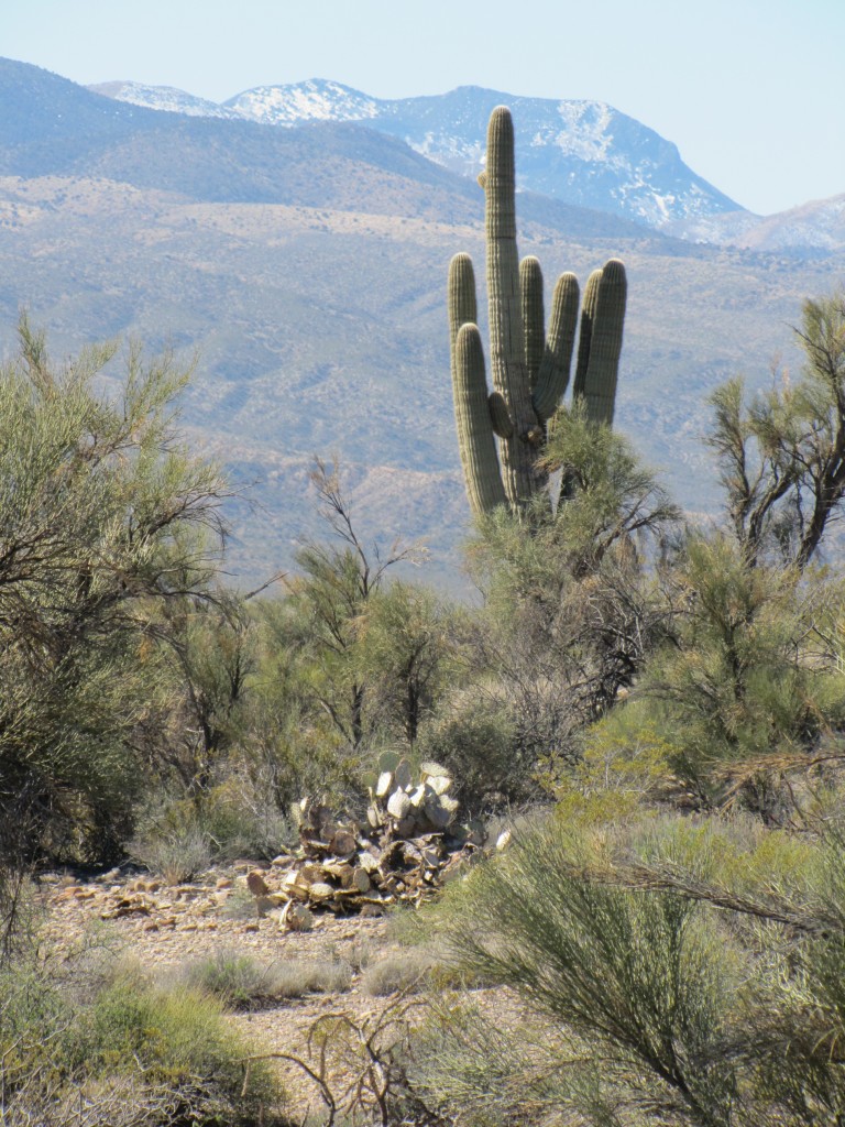
[vimeo clip_id="60967646" width="620"]

Not too far from the marker, the vegetation seemed to change and the hills became grassy and similar in color to the hills of Kansas.  However, unlike the Kansas grasslands, there were trees and bushes and even some prickly pear cactus, as I show in this next picture, taken at our third stop of the day.

Purple (center) and green (right) prickly pear cactus plants at 3rd rest stop along U.S. 70.

Purple (center) and green (right) prickly pear cactus plants at 3rd rest stop along U.S. 70.

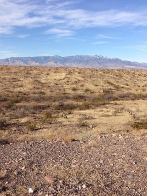
It was after this stop that the grassy nature appeared, as I tried to show and to discuss in this next video clip.
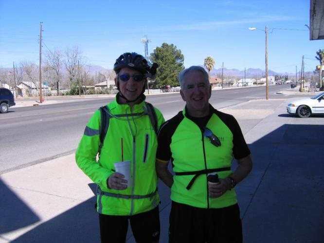
[vimeo clip_id="60967647" width="620"]

We made it to Duncan and met up with Beth, who had passed us along U.S. 70 about 30-40 minutes before we got there.  We had a nice lunch in Old Jo’s Cafe, which seems to be the only place in town where people can eat out.  We got there just before church let out and the place filled up with locals, most of whom gave us the typical strange looks we get when garbed in our biking outfits, all except Beth, of course.  Here is a shot of Tim and Mark at Old Jo’s Cafe.

Tim and Mark at Old Jo's Cafe, Duncan, AZ.

Tim and Mark at Old Jo’s Cafe, Duncan, AZ.

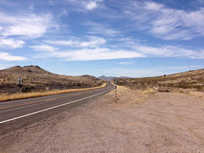
After lunch, we had about 36 or so miles in front of us.  At this point we were blessed with a strong tailwind, that took us into Lordsburg, NM in just about 2 hours, even with one more stop.   You come upon the State of New Mexico, shortly after leaving Duncan, AZ and here is a picture of Tim under the Welcome to NM sign.

Tim under Welcome to NM! sign.

Tim under Welcome to NM! sign.

Here is a video clip I took in appreciation for the great tailwind and the newly paved surface of U.S. 70.
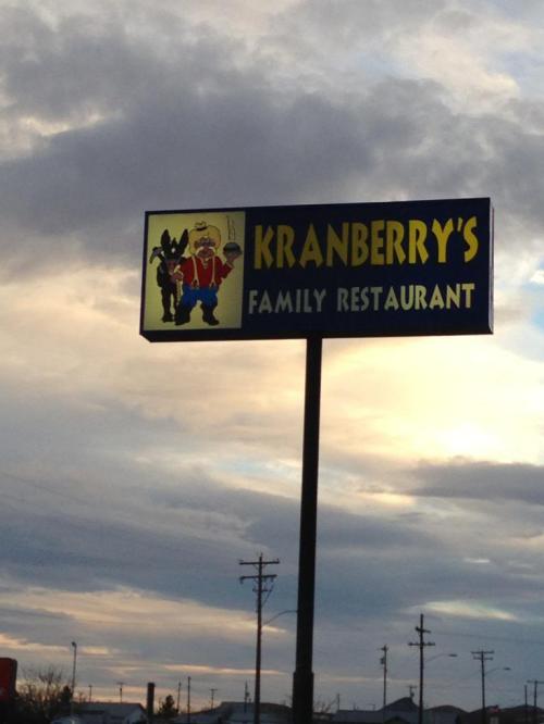
[vimeo clip_id="60972736" width="620"]

We made it to Lordsburg at about 3 o’clock, a distance of about 78 miles including a climb of about 1500 feet. Were it not for the tailwind, this would have been a much more difficult ride.  Tim and Mark went for a swim in the hotel pool (they didn’t get enough exercise? go figure!) while I showered and took a nap.  At 5 o’clock we met up in Beth’s room at our Comfort Inn and Suites (our nicest hotel thus far), to drink some beer, eat some snacks, and listen to Tim read about our next day’s ride in “Conquering the Borderlands.”  At about 6 o’clock, we went to dinner at Kranberries, a family restaurant not too far from our hotel.  Here are a few pictures I took at dinner.  Beth is talking to Marcia (Tim’s wife) in this next picture.

Beth and Tim at Kranberries Restaurant, Lordsburg, NM

Beth and Tim at Kranberries Restaurant, Lordsburg, NM

Tim ordered liver and onions for dinner.  Nancy and I remember eating with Tim at a restaurant in Upper Darby by the name of O’Malley’s, and he would always order liver and onions for his meal.  I remember it being very pungent, so whenever the restaurant was out of that dish, Nancy and I were glad.  But just for old times’ sake, here is a picture of Tim’s meal for tonight.

Tim's Liver and Onion dinner in Kranberries Restaurant, Lordsburg, NM.

Tim’s Liver and Onion dinner in Kranberries Restaurant, Lordsburg, NM.

Tomorrow we ride to Silver City, NM.  It’s only about 50 miles but we’ll be climbing about 1700 feet from our current elevation in Lordsburg and about 3000 feet from our lowest elevation during tomorrow’s ride.  Hopefully we’ll have another tailwind!

Our ride started out under a pretty blue sky with Tim singing “Oh, what a beautiful morning, oh, what a beautiful day,” and I couldn’t get that darn tune out of my head for the rest of the day. I don’t know any other words to it, nor do I know the other melody line that it must contain. Enough about that. So I was stuck with that little ear worm all day. I did find 8 pennies along the way. In the middle of nowhere. See a penny, pick it up. It’s the first loose change I’ve found. I also saw 2 foxes crossing the desert highway, a couple of hawks in flight and some black vultures. No, they were not circling above me. (We see mostly Turkey Vultures in Pennsylvania.)

Mt. Graham again dominated our southern vista for many miles beyond Safford. I would like to go to the top of it someday. There is a lake near the top and the views from up there must be incredible. Irrigated fields of hay on both sides of the road prevailed until we climbed out of the Gila Valley. Dry desert scenery with distant mountain ranges to our north and south continued until a few miles west of Duncan, AZ, which is 40 miles from Safford. Then we began to see more grass and trees with prickly pear cactus interspersed. My camera batteries died and my cell phone was just about dead so I didn’t get as many picture as I would have liked.

Today we also got chased by some more dogs. About the same story as yesterday. They just don’t give it their all and it’s hardly worth getting excited about. All the big, mean dogs are tied up or uninterested in bicyclists. Beth got the big dog scare today. She was chased back into “Midnight Rider” by a Doberman. You go girl!

I am sure Tim and Brian will rave to you readers about today’s tailwind. What a joy it was to ride the final 37 miles after lunch with a 20 mph tailwind. We were going up a small incline for all 37 miles and we were flying. The roads in Arizona are very well paved. Once in New Mexico, the asphalt was noticeably rougher for the first 15 miles. But then we came upon a newly paved, smooth as glass surface all the way into Lordsburg. Phenomenal! It had to be the easiest 76 mile ride I have ever done.

Mt. Graham was visible for many miles again today.

Mt. Graham was visible for many miles again today.

Field plowed and ready to get growing.

Field plowed and ready to get growing.

Dry desert after the Gila Valley with Mt. Graham still in the distance.

Dry desert after the Gila Valley with Mt. Graham still in the distance.

No tailwind yet. We take breaks about every hour for 5 minutes. They really help keep us going.

No tailwind yet. We take breaks about every hour for 5 minutes. They really help keep us going.

Tim reading to us again.

Tim reading to us again.

We met John L. He was heading West on Rt.70., doing a long Sunday morning ride. We talked about our coast to coast, multi-year adventure. He told us the route we are taking is a good choice. There is another route to Silver City that has some really hard, hard climbs. As it is, we still will cross the continental divide twice. Once at around 6,000 feet tomorrow and again the next day above 8,000 feet.

We met John L. He was heading West on Rt.70., doing a long Sunday morning ride. We talked about our coast to coast, multi-year adventure. He told us the route we are taking is a good choice. There is another route to Silver City that has some really hard, hard climbs. As it is, we still will cross the continental divide twice. Once at around 6,000 feet tomorrow and again the next day above 8,000 feet.

The tailwind is coming. The tailwind is coming.

The tailwind is coming. The tailwind is coming.

I'm getting some weird tan lines again. This one is from my watch, gloves and long sleeves. You should see Tim's right calf. Beets look pale in comparison.

I’m getting some weird tan lines again. This one is from my watch, gloves and long sleeves. You should see Tim’s right calf. Beets look pale in comparison.

A great place to eat in Lordsburg. Lots of food and great prices.

A great place to eat in Lordsburg. Lots of food and great prices.

It was rough country for the settlers even in 1895.

It was rough country for the settlers even in 1895.

After a great night’s sleep we rolled out of the motel parking lot at our usual 7:40am. When we got out of Safford, it was so crystal clear that I was struck by the first (and only verse I know) of Oklahoma.  So I belted out: ‘O what a beautiful morning, o what a beautiful day…’  I’m sure you know the rest of that verse.  Little did I know that that song would reverberate in Mark’s head for the rest of the day. Sorry about that little buddy.

As in the past mornings, we started shedding layers after an hour or so. It struck all of us how little traffic there was this morning. It helped that it was Sunday for sure. We went for 5 minutes many times without seeing a car in either direction. It reminded me of some of the running scenes in ‘Forrest Gump’. At one point Mark and I quested how many miles ahead there was this bend in the rode we could see. It turned out to be 6 miles.

We met up with Beth in Duncan, AZ for lunch at Ol Joe’s Cafe which is mentioned in ‘Conquering the Borderlands’. They do listen to my reading every night. We also passed the entrance to Sandra Day O’Connor’s family ranch which is also mentioned in the book.

The highlight was the tailwind after lunch, hence the title of this post. It was nothing short of marvelous. (I won’t tell you what Mark said, Holly). That was the fastest 78 mile ride I have ever done. Way to go God. My prayers were answered today. Lets see what tomorrow brings.

Thanks to everyone who participated in Name That Minivan! The majority chose correctly, and Midnight Rider is happy to have an official name at last. “Boy Blue” and “Midnight Blue” were tied in second place with four votes, and “Queensrÿche” ended up in third place with three.

About to head out of Globe and looking good

About to head out of Globe and looking good

Since I already knew that Midnight Rider would be the winning name (it was obviously the best and I’m glad many of you agreed), I started off my day’s drive listening to the song in the car. Just before the trip I reread my entries from last year, and in one of them I give my future self the advice to bring music so that I wouldn’t have to listen to country, Mexican, or Don Henley all the time. So I invested in a Spotify Premium account and a Bluetooth FM transmitter. I do like listening to the radio sometimes, just to get a sense of the town, but this new setup is fantastic. There’s nothing like driving in the middle of nowhere and singing with abandon.

Route 70 is two lanes, one lane in each direction, so cars pass while other cars are heading straight for them. I hate this — I hate doing it and I hate seeing other people do it. But I did it yesterday anyway because I guess I hate being behind really slow cars more than risking death.

Anyway, I survived, and the scenery was lovely.

One of the last saguaro cactus plants I saw

One of the last saguaro cactus plants I saw

Stray notes from the drive:

  • Don’t put a styrofoam cooler with bags on top of it right at the edge of the trunk because everything will spill out of it when you open the trunk.
  • I wish I could take pictures of people without them seeing me. I saw a Native American police officer washing his squad car while in uniform under a run-down carport next to his run-down home in Bylas — a striking image. And I’ve seen lots of other moments and tableaux that call out for a photo, but I’ve been too embarrassed to reach for my camera. I don’t want to treat the people who live in these places like they’re only anthropological curiosities (even if, because of the nature of this trip, they are such to me in the moment).  
  • Sometimes mountains look as fake in real life as they do in old movie backdrops.
  • A lot of thought has to go into highway planning and implementation. It’s remarkable that this country has so many roads, and that they’re basically consistent and reliable. Go federal works projects!

I checked in to our very nice Best Western at 12:30, had a beer, ate Triscuits, and wrote. The guys arrived around 3:30. No one seemed to want to hang out so I started watching The Apartment on TCM. Then Dad came over for tech support and we had a beer and watched the movie together. Then he and Tim went to church and Mark texted to see if I wanted to have a beer before dinner. Naturally I did.

We ate dinner at The Copper Steer, a steakhouse recommended by the woman at the check-in desk. It was really pretty good, despite having ill-considered banquet hall-style chairs. And I never thought I would say this, but it was nice to have a break from Mexican food. (Still, if I had to eat the same type of food every day for the rest of my life, that type of food would be Mexican.)

After dinner we all retired to my room for Tim’s nightly reading. Now you too can experience Tim reading! This is just a random snippet, and he didn’t know that I was recording. Unfortunately I didn’t capture the part where he mispronounced “tortilla” three times. Enjoy!

[vimeo clip_id="60942702" width="620"]

Hotel Art of the Day

L2-D3-Art

Satisfied cowboy with rainbow
Probably 18″x24″
Best Western, Safford, AZ

Hotel Art Score
8/10. This and its companion piece (of a rancher feeding his horse) were colorful (my photo doesn’t do it justice), location-appropriate, and schmaltzy in the best possible way. I find this delightful. And there is real sentiment here; I think the painter shares this cowboy’s love of the earth. While he’s not making me feel it, at least I feel him feeling it. And that makes me smile. And as a weary traveler I like to smile.

Art Art Score
4/10. Aside from the schmaltz factor, the technique is strangely unbalanced. The animals are pretty carefully rendered, but the background — especially the rainbow — is half-assed. I have suffered from a similar lack of balance in my own paintings, so I have sympathy.

We left our hotel in Globe at about 7:40 a.m. with the sun directly in our eyes and a ride of about 77 miles in front of us, our longest so far.  We had some climbing today, but overall our elevation dropped by about 600 feet.   Mostly the terrain seemed flat, although there were a few nice downhill rides.  Here is a video of one of them, shortly after we left Globe.

[vimeo clip_id="60918228" width="620"]

Not too far out of Globe, we left U.S. 60 and took U.S. 70 all the way to Safford, AZ.  Our journey was actually on the San Carlos Apache Indian Reservation most of the day.  We saw one casino but also saw road signs marking U.S. 70 and other Arizona highways, along with signs in the form of inverted arrow heads marking Indian highways on the reservation.  We made our first stop of the day a little more than an hour after leaving Globe.  Here is a picture I took on our first rest stop.

Tim and Mark some 10 miles out of Globe on US70.

Tim and Mark some 10 miles out of Globe on US70.

About 75 minutes later we made our second rest stop of the day.  Here are two pictures I took at that stop.

Mark and Tim at rest break along US 70

Mark and Tim at rest break along US 70

An Arizona Butte along US 70.

An Arizona Butte along US 70.  Note the prickly pear cacti in the foreground beyond the guardrail.

Beth met up with us at our next rest stop, by pulling over to the side of the road about an hour after our second stop.  By this time, Mount Graham is visible to our south and it stays with us for the rest of the day, sometimes making us feel that we’re not even moving!  Here is a shot of the snow capped Mount Graham, where there is supposed to be an observatory with a very powerful set of mirrors.

A shot of the snow capped peaks of Mount Graham along U.S. 70.

A shot of the snow capped peaks of Mount Graham along U.S. 70.

Not too long after this third rest stop, I took this video.  Ham that he is, Mark decided he wanted to be in the video, so you’ll see him move into the video shortly after I started taking it.

[vimeo clip_id="60918229" width="620"]

Our next stop was in a town called Bylas, by which point I was dragging and my feet were hurting from some Dr. Sholls’ inserts I had put in my shoes early in the morning before we left.  At the Bylas rest stop, I took them out and began to feel much better.  While walking around to get the feeling back in my feet, I took this picture of a horse.


Horse at rest stop in Bylas, AZ

Horse at rest stop in Bylas, AZ

We made a few more stops, but the best stop of the day was at a place called Taylor Freeze in Pima, AZ.  We had been seeing signs for Taylor Freeze for about 5 or 6 miles before we got there, and the signs did the trick of reeling us in to the place.  It reminded me of a Dairy Queen and the ice cream cones Mark and Tim bought and my strawberry milkshake tasted just as good as something from Dairy Queen.  Of course, the fact that we had ridden about 67 miles by that point might have contributed just a little to that sentiment.  Here is a shot of Mark and Tim enjoying their ice cream.

Tim and Mark at Taylor Freeze in Pima, AZ.

Tim and Mark at Taylor Freeze in Pima, AZ.

While we were enjoying our treats, we chatted with a family from Pima, which had moved there from San Diego to work in greenhouses there.  This fellow works growing beefsteak and grape tomatoes and mini cucumbers.  He’s been there for about seven years and purchased a home for about 10% of what it would have cost him (if he had been able to afford it) in San Diego.  There were all very nice and super friendly.

We had a little more riding to do but made it into Safford and our hotel by 3:30 p.m.  Tim and I went to a 6 p.m. mass at St. Rose of Lima Church in Safford, which was interesting for the congregation in attendance.  Unlike the nearly homogeneous east coast congregations, this one was about 1/3rd Anglo, 1/3rd Hispanic, and 1/3rd American Indian.  There was also at least one Asian family in attendance.  The liturgy was familiar and Tim and I knew all the songs, which were played by a guitar player in the back of the church in a choir loft.  There were also lots of young people in attendance, who didn’t all seem to be there with their parents, which is another difference from the east coast.

We all went to dinner afterwards at the Copper Steer just outside of town.  We all had steak (although Beth was good – her’s was with a green salad) and it was excellent!  Then it was back to Beth’s room for Tim to read to us from “Conquering the Borderlands” about what to expect on tomorrow’s ride.

After our usual 7 am breakfast at the hotel, we were off and riding at 7:40 am.  Skies were crystal blue and temps about the same as yesterday.  Looking forward to an easy 75 mile ride.  Not exactly.  76.7 miles to be exact and the extra hours in the saddle started to chafe all of our butts.  We made it but not without some pain.  The scenery is getting more and more breathtaking with each passing mile.

The highlight was ice cream cones at Taylor Freeze in Pima.  What a throwback in time.  It reminded all of us of a Dairy Queen when we were growing up.  Somebody even mentioned Dinny and the trips to the airport on Sunday nights to watch the planes come in for landings at the end of the airport runway, followed by ice cream, Dinny’s treat.

Tomorrow is a repeat of today (77 miles) but with some climbing thrown in for good measure.  We fortified ourselves with our first steak dinners of the trip.  I intend to wear long pants tomorrow.  My right leg is pretty sunburnt, despite multiple applications of sunscreen.  It needs a rest day from the sun.  A rest day from biking will not come until next Friday after we reach El Paso.  Many miles still to ride.

There is no better feeling for a bike rider doing a tour than finding your accommodations for the night after a long day’s ride. It feels even better when you stumble into the motel parking lot a few miles sooner than what you were calculating. Google maps and bike odometers are never synced precisely. Playing number games with the remaining mileage occupied my bored mind until the mile markers on the side of the road suddenly added a bunch of extra miles. After that I just couldn’t be sure exactly how many miles remained. The Adventure Cycling maps showed the town of Thatcher to be about 4 miles west of Safford. In fact, though, the two towns just run together so I didn’t even realize I was in Safford when Tim pulled into the Best Western Desert Inn parking lot. I thought he might have the wrong motel and that we would have to keep pedaling to get to the right one. What a great feeling when your room and a hot shower are minutes away.

Today’s ride actually lost elevation. Safford is maybe 500 feet below Globe. But the 76 miles were long ones for some reason. We had a slight headwind all day. Our waitress at breakfast this morning warned us about the wind around Safford and I guess she was right. We even saw a small dust storm. Brian was too slow processing my urging to take a quick video before we went around it. He had a very hard day today so we’ ll cut him some slack. He had a little case of Montezuma’s revenge from too many enchiladas last night. Or maybe it was that large strawberry margarita. He was feeling poorly all day. I gave him Motrin and Tylenol and he eventually got his second wind and felt better. Tim and I asked him during one of our many brief rest stops if he wanted to quit today so he could rest up and not get so weak that the rest of the trip was in jeopardy. But he said he could make and he did.

Another thing that a long distance bike rider loves is not being lost. Yesterday was one long ride on Rt. 60 East. No turns at all. Didn’t need any directions. That makes riding so much easier. (Rt. 60 East is the same road we took last year into Salome, Wickenburg and Phoenix.) Today’s ride started on Rt.60 until 1 mile east of Globe where it runs right into Rt.70 East. Nice and simple. (One of the worst days last year was the day we got lost climbing out of Pine Valley.)

Today we rode mostly through San Carlos Apache Indian Reservation. We were warned about loose dogs chasing bicyclists and sure enough, a pack saw us a gave chase. The leader was a terrier mix and he gave up much too quickly. I was ready with my water bottle and I had my voice commands to yell but I didn’t need either. Oh well, now we can say we were attacked but we sprinted away so fast they gave up.

No motorcycles today. Fewer cars and trucks but more than I expected for a Saturday. Unbelievable amount of road litter. You just can’t imagine how much trash is tossed on the side of the roads out here. Heard one rooster. Smelled some good wood smoke from outside fires. Talked to a young farmer and his wife and family. He was from California and moved here to start his own green house vegetable farm. Sells to Costco and WalMart. Loves it out here.

A beautiful day at our first rest stop 12 miles east of Globe.

A beautiful day at our first rest stop 12 miles east of Globe.

This is what San Carlos Reservation sometimes looks like.

This is what San Carlos Reservation sometimes looks like.

This is all that you can see of the town of Geronimo, AZ. It is at the eastern end of the reservation.

This is all that you can see of the town of Geronimo, AZ. It is at the eastern end of the reservation.

I posted a picture of a Historical Marker yesterday and felt bad that it wasn't readable. This picture makes up for that. Enjoy. Imagine Tim reading it out loud for your listening pleasure.

I posted a picture of a Historical Marker yesterday and felt bad that it wasn’t readable. This picture makes up for that. Enjoy. Imagine Tim reading it out loud for your listening pleasure.

These snow capped mountains were visible all day. They helped keep my eyes away from the trash on the road side.

These snow capped mountains were visible all day. They helped keep my eyes away from the trash on the road side.

In the distance ahead is Mt. Graham. The Vatican owns an observatory on top. They are trying to use it to study the origin of the universe. Galileo would never believe it.

In the distance ahead is Mt. Graham. The Vatican owns an observatory on top. They are trying to use it to study the origin of the universe. Galileo would never believe it.

We saw the signs for Taylor Freeze every half mile for 5 or so miles. No way we could pass without stopping. It was great. The temperature here is 72. This is where we met the farmer and his family.

We saw the signs for Taylor Freeze every half mile for 5 or so miles. No way we could pass without stopping. It was great. The temperature here is 72. This is where we met the farmer and his family.

The riders have resolved to start their days earlier this year; it’ll give them more time for snacks, relaxation, and sleep. Besides, we’re all still on east coast time, anyway. On Day 2 we ate breakfast at 7 a.m.; they departed at 7:40. I hung out under the harsh fluorescent lights of my room till 10, then headed out to meet the guys for lunch in Superior before the scary tunnel ride.

Sorry your eyes are closed, Tim! Everyone still looks good.

Oops, this isn’t the best photo — sorry, Tim!

The drive was spectacular, with beautiful vegetation for miles. I wish I’d had time to stop and take it in better, but the guys were speedier than expected and ended up waiting for me for half an hour at a rest area.

L2 D2 02

Lunch at a cute Mexican diner in Superior, AZ

After chicken tacos for me, a burger for Mark, and grilled cheese sandwiches probably fried in lard for the Lent observers, we went back to the car to put the video camera on Dad’s helmet. I gave them a head start to the tunnel, which was a few miles away, and headed to the rest stop’s ladies’ room for some “rest.”

This was the grossest restroom I’ve ever encountered. I’ve seen a lot of public bathrooms in my time (hundreds, surely), but things were happening here (or rather, had happened) that no one should ever have to face. I will spare you the details, but I am mystified by the aspect of human nature that inspires people to make a bad situation worse. I suppose it’s resentment at having been made to experience the bad situation in the first place. Anyway, ugh.

IMG_0992

The bathroom looks clean, yes, but this unflattering self-portrait illustrates my disgust and hides the awfulness directly behind me

I shook it off, though, to focus on Project Get the Guys Through the Tunnel Safely. I passed them on the highway, then pulled off the road just before the tunnel entrance.

A few minutes later, the riders showed up in my rear view mirror. But gravel, Dad’s nemesis, felled him just as they reached the long pull-off. The guys were about a football field away from me, tiny yellow specks, and it seemed like the fall happened in slow motion, or like I was watching it on a screen — maybe because I saw it in the mirror. I was slow to react, eventually realizing I should get out of the car to see if they needed my help. I yelled, “Are you all right?” and it echoed off the mountain satisfyingly. Tim answered yes. Dad, though his knee was bleeding and his hip was/is probably bruised, soldiered on.

I’d like to pause here to say that if I’d been in Dad’s position, I would a) have felt light-headed just knowing my knee was bleeding; b) be terrified that I had to do something dangerous just after a painful, distracting fall; c) not go through with it, obviously; and d) not have done any of this in the first place, so this speculation is pointless.

IMG_0999

Dad walking off the fall

As the SAG driver, I’d been dreading this part of the trip, expecting angry cars to pile up behind me, unable to see that I was saving them from charges of unintentional manslaughter. I’d also had additional anxious thoughts about my anxiety causing me to do something rash, like speed up and/or swerve, causing a disastrous chain of events resulting in the death of us all. But the tunnel was short, and traffic was pretty light, and for the most part other drivers were cool. As Tim mentioned, only one person honked angrily, but he gave an “I take it back” honk once he saw what was going on. Thanks, dude.

After we made it through, I realized I’d been holding my breath. Everyone was okay, so I headed off to the Quality Inn in Globe.

Though my room smelled vaguely of farts, it was otherwise very nice. I settled in. The guys arrived two hours earlier than expected, around 2:30. We took our daily bread (beer, chips, crackers — oh, plus delicious artisanal chocolate courtesy Holly [thank you!!]) in Dad’s room and listened to Tim read another chapter of Conquering the Borderlands.

We chased down the snacks with an early Mexican dinner, probably the most authentic Mexican food (as well as the best restaurant sign) we’ve experienced in both legs so far. Dad already wrote about this, but here it is again:

IMG_1000

The man is dreaming of a beautiful lady bringing him food, and his wife is about to hit him with a rolling pin

Then we went back to Safeway for supplies, and I’m only mentioning this because there was an amusement park in the parking lot:

IMG_1004

Rides in this setting were otherworldly, both ugly and beautiful

And that’s that for Day 2. But it’s time to introduce a new daily feature! Last year had salsa. This year has ART.

Hotel Artwork of the Day

Contemporary hospitality interior design theory seems to believe that paintings should not invite contemplation; that they should instead underscore the room’s sense of comfort, relaxation, and luxury by blending in with the decor. In other words (because I know Dad is lost after the last sentence), most hotel rooms don’t want you to really look at their art, at least not more than you look at the bedspread. If you’re going to think about the artwork at all, they want you to think, “Oh, that’s a nice painting,” and nothing more.

But maybe there’s nothing wrong with that! While I generally think art should be more than a bit player in an interior design concept, it kind of makes sense in hotels. Being forced by the wall to think about something on it is not necessarily what the average weary traveler wants.

Uh oh, I could go on about this for paragraphs. Don’t worry, I won’t.

Anyway, I’m going to grade the art we encounter on how good it is as hotel art and how good it is as art that might purport to something greater. Obviously, please disagree with my opinions in the comments.

Let’s take a look at our first specimen:

IMG_1012

Scribbled lines on soft blocks of color
Approx. 16″x16″ print
Quality Inn, Globe, Arizona

To me this feels like art at its most cynical. There is no discernible soul; it is actually noticeable for not being nice. Also it is boring. It’s hard for me to believe that the artist had any idea in mind other than to make money by churning out some hotel room art. Perhaps the scribbles suggest frustration at only being able to earn a living through crappy stuff like this. The background is painterly, at least. Still.

Hotel Art Score: 4/10
It basically blended in with the decor, but the angry lines work against my sense of relaxation. If they’re supposed to be whimsical they’re failing me. Also the square size was awkward for this particular room. Subpar all around.

Art Art Score: 2/10
Come on, it’s terrible.

This was a long day but not too long.  Mark picked me up at my house at 4:45 a.m. EST (2:45 a.m. Arizona Time) and we drove to the airport, checked ourselves and our bags in, and made it through security in record time.  Our US Airways (soon to be American Airlines) flight to Phoenix was uneventful and I was able to work the entire time and get everything finished that I had planned to.  Our flight made it in to Phoenix almost an hour early and Mark’s and my checked luggage was the very first out!  I called Beth (who, along with Tim had flown in the prior evening) and she arrived to pick us up and take us to the Tempe Marriott Courtyard, the same hotel we ended at on last year’s leg (L1 using Beth’s acronym).  After (mostly) assembling my bike and after Mark (completely) assembled his, and after a quick lunch in Tempe, we were on our way.  We only had 25 miles or so on this first day’s ride, so we only made one stop.  Here is a photo from our only rest stop, which was at a QT store along our route.

Mark and Tim outside QT store rest stop.

Mark and Tim outside QT store rest stop.

We made it into Apache Junction with about 2 hours or so of riding.  Once there, we picked up our daily ritual of drinking a few cold ales, munching on snacks, and listening to Tim reading from “Conquering the Borderlands,” by Lorraine Viesz.  Ms. Viesz was a rider on the annual Women’s tour of the Southern Tier route, and wrote a book about her ride and the history of all the places along the route, which she published in 2009.  Mark, Tim and I all read it before L1, but Tim’s daily reading reminds us of things we have forgotten.  Here is a shot of Tim reading to us, as we toss down some cold ones.

Tim reading from "Conquering the Boderlands," while Mark listens intently! :)

Tim reading from “Conquering the Borderlands,” while Mark listens intently! 🙂

Well, OK, maybe he’s not actually on the edge of his seat.  But Beth is listening, for real! 🙂

Beth actually listening to Tim read!

Beth actually listening to Tim read!

For me, the highlight of the day was getting out of the Phoenix urban sprawl and back into the Arizona desert.  Here is a photo showing a Saguara in the midst of several verde trees.

Saguara Cactus and Verde trees in Apache Junction, AZ

Saguara Cactus and Verde trees in Apache Junction, AZ

We had an OK dinner (and some very good margarita’s), and then returned to the Best Western after picking up more supplies at a Safeway in Apache Junction.  I fell asleep within minutes of getting back to my room, which is why I didn’t post last night.  From here on, I expect to do my homework (aka blog posting) every evening before bed. 🙂


mark-02-01

A canopy blue sky and a backdrop of mountains all day long.

A canopy blue sky and a backdrop of mountains all day long.

Today was a day of climbing, traffic, noise, car exhaust and breathtaking beauty. We rode through the Queen Creek Tunnel, which we have been dreading. But it wasn’t bad at all even though traffic was heavy and it was around 1PM on a Friday. (Sunday is the best day to attempt that tunnel on a bike.)

The western entrance to the tunnel.

The western entrance to the tunnel.

Again today we were on moderately congested roads for the most part. Rt. 60 is a 4 lane divided highway for about 20 or so miles out of Apache Junction. Wide shoulders except for stretches with guard rails that narrow toward the rumble strip. But a very smooth surface for all 55 miles. Temperatures in the 50’s to start and upper 60’s by later in the day. There was snow on the north facing mountainsides at the higher elevations. I think we saw a sign indicating 4880 as our high point. Lots of cholla, prickly pear and saguaro cactus followed by pine forest as we got higher in the mountains.

Cactus and green desert scenery at our first rest stop 18 miles east of Apache Junction.

Cactus and green desert scenery at our first rest stop 18 miles east of Apache Junction.

I wanted to stop and take pictures almost every mile. It was just a day for Kodak moments. Here’s the best examples.

An old mining trail before the tunnel entrance.

An old mining trail before the tunnel entrance.

Wild flowers in bloom.

Wild flowers in bloom.

Some RV's are cooler than others.

Some RV’s are cooler than others.

Tim liked Tonto National Forest.

Tim liked Tonto National Forest.

mark-02-09

Lots of strip mines. This one near Superior, AZ started as a silver mine until copper and zinc ore was discovered. It is amazing how much of the landscape is destroyed. There was one strip mine we saw that went for miles.

Lots of strip mines. This one near Superior, AZ started as a silver mine until copper and zinc ore was discovered. It is amazing how much of the landscape is destroyed. There was one strip mine we saw that went for miles.

Many historical markers that cars probably miss.

Many historical markers that cars probably miss.

Tomorrow is a longer ride of 76 miles to Safford, AZ. It will be our last full day ride in this great state. Sunday we will end somewhere inside New Mexico.